Southampton by John Doswell
Back to: Hampshire | Antique City maps
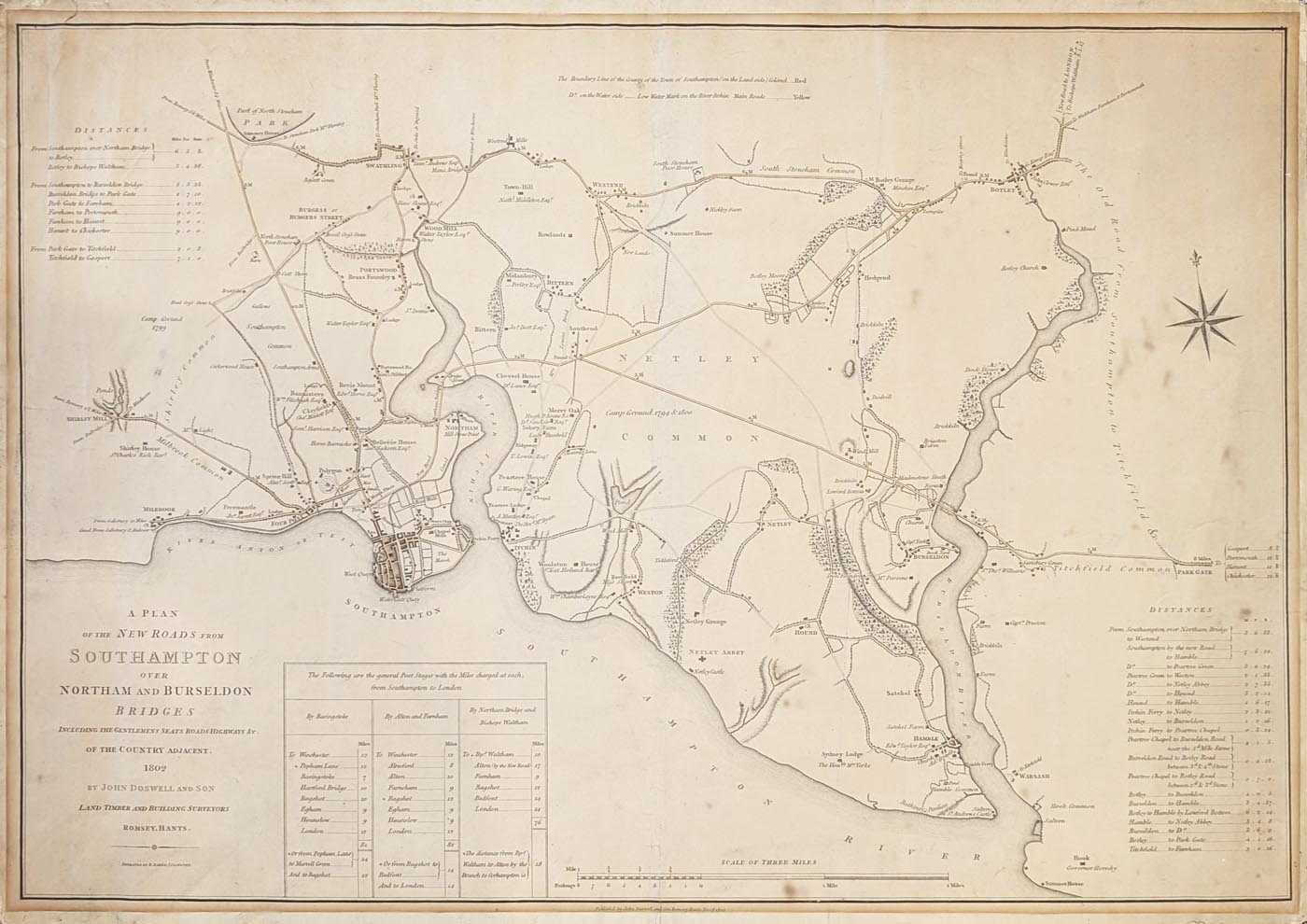
Title: A Plan of the New Roads from Southampton over Northam and Burlesdon Bridges Including the Gentlemen's Seats, Roads, Highways &c. of the Country Adjacent. 1802 by John Doswell and Son, Land, Timber and Building Surveyors, Romsey, Hants.
Publication: John Doswell and Son, Romsey, Hants.
Date: Nov. 8th 1802
Description: Extensive plan of Southampton and the surrounding area engraved by Benjamin Baker. Shirley Mill in the west, Warsash in the east and Westend and Botley in the North. A table of 'General Post Stages with the Miles charged at at ech, from Southampton to London'. A mileage scale of 2.5" to the mile and to the bottom right a table of distances from Southampton. Very detailed with all the major country houses and their owners. Woodlands, mills and pods are clearly annotated. Very scarce.
From the Hampshire County Council archive: 'Shows an area between Shirley (west), Swaythling and Botley (north), Park Gate (east) and Southampton Water (south). Includes Bursledon Bridge, identified in printing, and the Bursledon Bridge Road, identified in manuscript. Many of the seats of the local gentry are identified with the names of the properties and/or their owners or occupiers (many of which have been updated in manuscript), including Shirley House, Cockerwood House (near Shirley), Freemantle, houses in Southampton such as Bannisters, Clayfields, Bevis Mount, Belle Vue House, and Portswood House, South Stoneham House, Wood Mill, Town Hill [Townhill], Midanbury, Bittern [Bitterne], Chessel House Merry Oak, Sidney Farm, Ridgeway, Peartree House, Peartree Lodge, Woolston House, Barnfield (near Weston), Sydney Lodge (Hamble), Botley Grange and Hook. Other place-names and features shown include the canal from salisbury and Andover entering Southampton via Millbrook and passing through a tunnel in the West Marlands and Moira Place area to a junction with a canal from Northam Wharf to a point near Watergate Quay, various features in Southampton including a rope walk, the new Southampton reservoir near Southampton Common, camp ground at Shirley Common in 1799, Head Cross Stone, a brass foundry at Portswood, North Stoneham Poor House, summer house in North Stoneham Park, Burgess or Burgers Street, Haven Stone near Wood Mill, Westend [West End] Mills, Bridge Tavern (Bitterne), Mrs Lewin's Road between Pear Tree and Bitterne, South Stoneham Poor House near Hickley Farm, camp ground in 1794 and 1800 on Netley Common, an iron foundry between Hound and Bursledon, Maidenstone Heath and Brigston Farm (both north of Bursledon village), a bathing pavilion on Hamble Common, Hamble Ferry, Botley Moors, Botley Holmes, Dodvill, Hedgend [Hedge End], Pink Mead, and 'the old road from Southampton to Titchfield' (via Botley and Park Gate). Includes tables giving distances between local towns via Northam Bridge, Bursledon Bridge, etc, and distances charged between post stages from Southampton to London via Basingstoke, Alton and Farnham, and Northam Bridge and Bishops Waltham.'
Condition: Laid on linen, age toning and old mount mark to margins. Two closed splits. Bold impression with some original hand colouring.
Image size: 465 x 680mm, 18.25 x 26.75" approx.
SOLD
Order No. 4955
Georgian map of Southampton and surrounding area.
Mon - Closed
Tues-Fri 10am-1.30pm, 2.30-5.30pm
Sat 10am-1.30pm
 Free UK Mainland Delivery*
9 Church Street
Modbury
Devon PL21 0QW. UK
01548 830872