
Antique Maps of Cumberland
Explore our collection of original antique maps of Cumberland, the historic county in the north-west of England, within the wider area now commonly associated with Cumbria. Our selection also includes maps depicting parts of the Lake District and surrounding counties. These attractive and collectible maps date from the 17th to the 19th centuries and were produced by some of Britain's most recognised historical mapmakers.
These old maps of Cumberland offer a fascinating picture of the county before modern mapping. They show historic towns, villages, roads, rivers and the changing landscape of northern England. Places featured include Carlisle, Keswick, Whitehaven, Workington and Ravenglass.
Our collection includes maps by celebrated cartographers including Robert Morden, Thomas Moule, Thomas Jenner and John and Charles Walker. Printed using traditional copperplate and steel engraving techniques, many examples retain their original or later hand colouring.
- Original antique maps dating from the 17th to 19th centuries.
- Historic county maps of Cumberland and the surrounding Lake District area.
- Notable mapmakers including Robert Morden, Thomas Moule and Thomas Jenner.
- Decorative hand-coloured copperplate and steel engravings.
- Interesting historic place names including Carlisle, Keswick, Whitehaven and Workington.
Whether you are looking for an antique map of Cumberland for a collection, a historical reference or an attractive piece of wall decoration, our selection offers examples from several important periods of British cartography.
Click on an image below to view individual maps, photographs, descriptions and prices.
FREE UK Mainland Delivery

Original Historic Maps of Cumberland, Cumbria and the Lake District
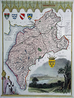
Cumberland
Thomas Moule
Circa 1836–1850
Decorative county map
£60.00

Cumberland
Robert Morden
Circa 1695
Hand coloured antique map
£120.00
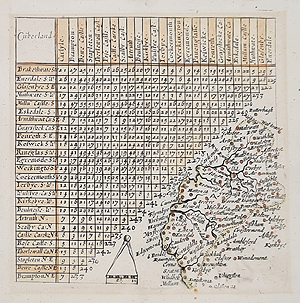
Cumberland
Thomas Jenner
1643
Sold – historical example
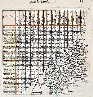
Cumberland
Thomas Jenner
1657
£65.00 – Scarce
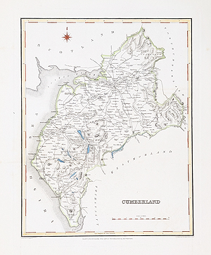
Cumberland
Robert Creighton and J. & C. Walker
Circa 1831
£34.95
Antique Maps of Cumberland and Cumbria – 17th to 19th Century
Our antique maps of Cumberland provide an interesting record of the historic county and its towns, villages and landscape. Cumberland was one of the historic counties of north-west England and is now part of modern Cumbria. The area includes much of the northern and western Lake District.
17th Century Maps of Cumberland by Thomas Jenner and Robert Morden
Among the earlier examples are two scarce maps by Thomas Jenner, dated 1643 and 1657. These historic maps are particularly interesting for their early depiction of the county and the inclusion of mileage information showing distances between towns.
Robert Morden's map of Cumberland, circa 1695, is another important example. Published in connection with Camden's Britannia, it is hand coloured and features a decorative scroll title cartouche. Morden is widely recognised for his contribution to the development of English county mapping.
Decorative 19th Century Cumberland Maps
For collectors and those looking for decorative antique maps, the 19th century examples are particularly attractive. Thomas Moule's map of Cumberland, dating from circa 1836–1850, features his distinctive decorative style and heraldic ornamentation.
The collection also includes a map by Robert Creighton and John and Charles Walker, dating from circa 1831. These maps offer a fascinating insight into the appearance of Cumberland during the 19th century.
Buying Original Antique Maps of Cumberland
All our maps are offered as original historical prints rather than modern reproductions. Individual product pages provide further details, photographs, dates and prices. We offer free UK mainland delivery.
You may also be interested in our collections of antique maps of Westmorland, antique maps of Lancashire, antique maps of Northumberland and antique maps of the British Isles.
Mon - Closed
Tues-Fri 10am-1.30pm, 2.30-5.30pm
Sat 10am-1.30pm
© Devonshire Fine Art
Free UK Mainland Delivery*
9 Church Street
Modbury
Devon PL21 0QW. UK
01548 830872


