
Antique Maps of Bedfordshire for Sale
Original Bedfordshire County Maps from the 18th and 19th Centuries
Explore our collection of antique maps of Bedfordshire, featuring original historic county maps dating from the 18th and 19th centuries. These maps offer a fascinating glimpse into the history of Bedfordshire, its towns, villages, roads and changing landscape.
Our collection includes maps by notable cartographers and publishers such as Thomas Moule, Emanuel Bowen, George Bickham, Pigot and the mapmakers Robert Creighton and J. & C. Walker. Whether you are looking for a historical map of Bedfordshire for a collection, a distinctive gift or an attractive piece of wall art, explore the individual listings below for details of each map's date, condition and price.
Click on any map to view further details and purchase information. We offer UK mainland delivery, and you can also explore our wider collection of antique maps of the British Isles and map framing options.

Antique Map of Bedfordshire, 1796
George Bickham
18th-century county map
An attractive historic map of Bedfordshire, ideal for collectors of antique maps and those with an interest in the county's history.
£155.00
View map details

Antique Map of Bedfordshire
Thomas Moule
Circa 1840–1850
Original antique county map
£58.00
View map details and purchase

Antique Map of Bedfordshire, c.1832
Pigot
19th-century county map
A historic map of Bedfordshire from the early Victorian period, ideal for collectors of antique maps and anyone interested in the history of the county.
£45.00
View map details

Antique Map of Bedfordshire, c.1720
John Owen and Emanuel Bowen
Early 18th-century county map
An early Georgian map of Bedfordshire, offering a glimpse of the county's historic geography. An appealing addition to a collection of antique maps or a gift for someone with local interests.
£45.00
View map details
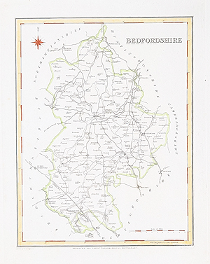
Antique Map of Bedfordshire, c.1831
Robert Creighton and J. & C. Walker
19th-century county map
A historic map of Bedfordshire from the early 19th century, ideal for collectors of antique county maps and those interested in the history of the area.
£29.95
View map details
Explore the History of Bedfordshire Through Antique Maps
Historic maps of Bedfordshire reveal how the county was represented by cartographers during the 18th and 19th centuries. They can show the development of towns and villages, the network of roads connecting local communities, and the changing representation of the surrounding countryside.
Different mapmakers produced maps for atlases, geographical publications and county histories. Their work varies in style, scale, decorative detail and colouring, making individual examples interesting to collectors and anyone researching the history of Bedfordshire.
Browse our available Bedfordshire antique maps, or discover more historic county maps in our collection of antique maps of the British Isles.
Mon - Closed
Tues-Fri 10am-1.30pm, 2.30-5.30pm
Sat 10am-1.30pm
© Devonshire Fine Art
 Free UK Mainland Delivery*
9 Church Street
Modbury
Devon PL21 0QW. UK
01548 830872


