
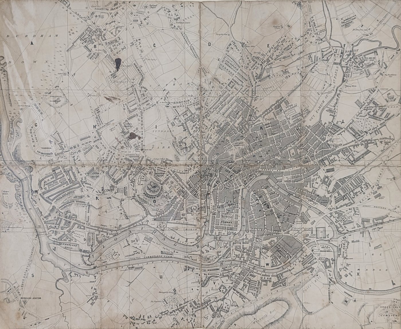
Antique Map of Bristol, Attributed to John Ashmead, c.1840
Discover an antique map of Bristol dating from circa 1840, attributed to John Ashmead. This nineteenth-century map shows Bristol's historic streets, the River Avon and the Floating Harbour, offering a view of the city during a period of urban and commercial development.
The map is uncoloured, laid on linen and retains its folding format. It shows age toning, wear and strengthening to the folds, and has been trimmed to the image without a border. Measuring approximately 415 × 510 mm, it is an interesting piece for collectors of antique maps, Bristol history and historical cartography.
Map Details and Condition
- Title: Bristol
- Cartographer: Attributed to John Ashmead
- Date: Circa 1840
- Publication: Unknown
- Technique: Uncoloured map laid on linen
- Image size: 415 × 510 mm (approximately 16.5 × 20 inches)
- Condition: Age toning, wear and strengthening to the folds; trimmed to the image without a border
- Order number: 4562
- Price: £95.00
Antique map framing suggestions
About this Antique Map of Bristol
This example is uncoloured and is in folding condition as originally published and laid on linen. There is some age toning, wear and strengthening to the folds.
Historical Features Shown on the Map
This antique map provides a historical view of Bristol during the nineteenth century. The depicted area extends from Clifton towards St Paul's, with the River Avon and Bristol's Floating Harbour forming important geographical features. These details make the map of interest to collectors of Bristol history, antique city maps and historical cartography.
Condition and Map Details
The map is uncoloured and laid on linen, retaining its original folding format. It shows age toning, wear and strengthening to the folds. The image measures approximately 415 × 510 mm, and the sheet has been trimmed to the image without a border. Please examine the photographs and contact us if you require further condition details before purchase.
Related Maps
Frequently Asked Questions About This Antique Bristol Map
How old is this antique map of Bristol?
The map is dated circa 1840, subject to confirmation of its publication date. It is an example of nineteenth-century historical cartography.
Is the map attributed to John Ashmead?
The map is attributed to John Ashmead, although the attribution should be regarded as tentative unless supported by further bibliographical evidence.
What is the condition of the map?
The map is uncoloured and laid on linen in its original folding format. It has some age toning, wear and strengthening to the folds, and is trimmed to the image without a border.
What are the dimensions of the map?
The image measures approximately 415 × 510 mm, or 16.5 × 20 inches.
Can this antique Bristol map be framed?
Yes, framing options can be discussed. See our antique map framing suggestions for further information.
Do you offer UK delivery?
Free UK mainland delivery is advertised on our website. Please consult our delivery information for the applicable terms.
Mon - Closed
Tues-Fri 10am-1.30pm, 2.30-5.30pm
Sat 10am-1.30pm
© Devonshire Fine Art
 Free UK Mainland Delivery*
9 Church Street
Modbury
Devon PL21 0QW. UK
01548 830872


