
Antique Map of Devonshire by Joshua Archer, 1833
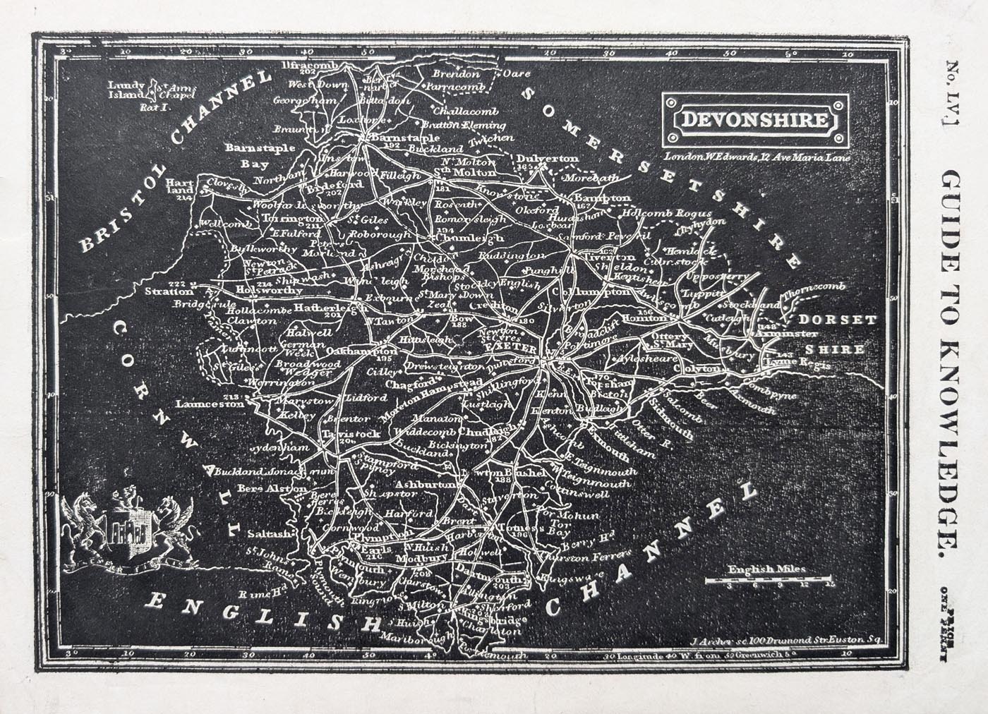
Antique Map of Devonshire, 1833
This unusual original antique map of Devonshire was engraved by Joshua Archer and published in 1833 for William Pinnock's The Guide to Knowledge. It is a distinctive example of early nineteenth-century county mapping, produced using a woodcut printing technique with an unusual white-on-black appearance and attractive early hand colouring.
The map includes the imprint of W. E. Edwards, 12 Ave Maria Lane, London, and was issued as part of Pinnock's educational publication. Its distinctive appearance and historical interest make it an appealing addition to a collection of antique Devon maps or a decorative feature for the home.
This original 1833 Devonshire map is available from Antique Maps Online for £35.
Title: Devonshire
Cartographer / Engraver: Joshua Archer
Publisher: London. W. E. Edwards 12 Ave Maria Lane.
Publication: The Guide to knowledge. Edited by W. Pinnock... Vol. 1
Date: 1833
Size: 165 x 225mm, 6.4 x 9 inches
Description: Unusual county map, white on black. First Edition.
Condition: Good imprint and paper, minor age-related blemishes, with attractive early hand colouring.
Price: £35.00
Order No: 5043
About this Antique Map of Devonshire
This original antique map of Devonshire was published in 1833 during the reign of King William IV. It is an unusual example of nineteenth-century county mapping, produced using a woodcut printing process that gives the map its distinctive white-on-black appearance.
Published in William Pinnock's The Guide to Knowledge, the map combines geographical information with the characteristic printed style of early nineteenth-century educational publications. The attractive early hand colouring adds further character to this unusual representation of Devonshire.
Joshua Archer and Nineteenth-Century Map Publishing
Joshua Archer was a nineteenth-century engraver associated with the production of maps for geographical, historical and topographical publications.
His work included maps for Thomas Dugdale's Curiosities of Great Britain, a work featuring descriptions and illustrations of British counties, towns and notable places. Archer also produced maps for other publishers and educational publications.
The Devonshire map featured here is associated with William Pinnock's The Guide to Knowledge, published in London in 1833. Its unusual woodcut printing style makes it an interesting example of the varied techniques used in nineteenth-century map production.
Details of the Antique Devonshire Map
- County: Devonshire
- Date: 1833
- Publication: London
- Features: Wood cut white on black.
- Size: 165 x 225mm, 6.4 x 9 inches
- Colour: Early hand colouring
- Condition: Good imprint and paper, minor age-related blemishes
- Price: £35.00
Antique Map Framing
This original antique map can be purchased unframed or with a choice of framing options. Visit our antique map framing page to explore the available frames and glazing options.
Explore More Antique Maps of Devon
Discover more historic maps of Devonshire in our collection of antique maps of Devon. Our collection includes maps from different periods, allowing you to explore how the county has been represented by cartographers over the centuries.
You can also browse our antique maps of the British Isles and see the latest additions to our collection.
Mon - Closed
Tues-Fri 10am-1.30pm, 2.30-5.30pm
Sat 10am-1.30pm
© Devonshire Fine Art
 Free UK Mainland Delivery*
9 Church Street
Modbury
Devon PL21 0QW. UK
01548 830872


