
Antique Map of Devonshire by Thomas Kitchin, 1786
Explore our collection of antique maps of Devon, including maps by Thomas Kitchin and other notable cartographers.
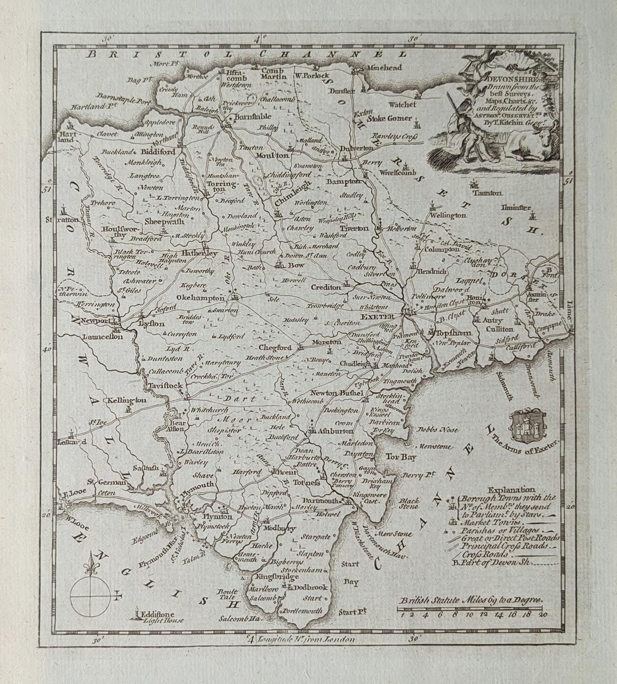
An Original 18th-Century Map of Devon
This original antique map of Devonshire was published in 1786 by the renowned English cartographer Thomas Kitchin. It appeared in England Displayed, an illustrated geographical publication featuring maps of the English counties.
The map is titled "Devonshire Drawn from the Best Surveys, Maps, Charts etc. and Regulated by Astronomical Observations". It is an attractive example of 18th-century British cartography, combining geographical detail with decorative engraving.
A particularly appealing feature is its decorative figurative title cartouche, accompanied by the Arms of Exeter. The map identifies important Devonshire towns and places, including Exeter, Plymouth, Plympton, Honiton, Barnstaple and Ilfracombe.
Published during the 18th century, this historic map offers an interesting record of Devon before the extensive changes brought about by modern transport and urban development.
The map has a good imprint and paper, with minor age discolouration and later hand colouring. Its decorative appearance makes it suitable for collectors of antique maps, those with an interest in Devonshire history and anyone looking for an unusual piece of historical wall art.
Details of this Antique Devonshire Map
- Cartographer: Thomas Kitchin
- Date: 1786
- Publication: Historical Descriptions of New and Elegant Views of the Antiquities of England and Wales
- Subject: Devonshire, England
- Decorative features: Figurative title cartouche and Arms of Exeter
- Towns shown: Exeter, Plymouth, Plympton, Honiton, Barnstaple and Ilfracombe
- Condition: Good imprint and paper, minor age discolouration, uncoloured on blue paper.
- Image size: 210 x 180mm
- Price: £95.00
- Order reference: 5026
An attractive and relatively affordable 18th-century antique map of Devonshire, ideal for collectors and anyone with an interest in the history of the county.
Explore more of our antique maps of Devon or browse other historic maps by Thomas Kitchin.
About This Antique Map of Devonshire
An original 1786 antique map of Devonshire by Thomas Kitchin, featuring an attractive figurative title cartouche and the Arms of Exeter. This detailed 18th-century engraving includes Exeter, Plymouth, Honiton, Barnstaple, Ilfracombe and other Devon towns.
The map is uncoloured and printed on blue paper, measuring approximately 210 x 180mm. It retains a good imprint and sound paper, with minor age-related discolouration.
Price: £95.00. Optional framing and specialist glass are available.
Browse our antique maps of Devon or discover more maps by Thomas Kitchin.
Mon - Closed
Tues-Fri 10am-1.30pm, 2.30-5.30pm
Sat 10am-1.30pm
© Devonshire Fine Art
 Free UK Mainland Delivery*
9 Church Street
Modbury
Devon PL21 0QW. UK
01548 830872


