
Antique Map of Devon by Reuben Ramble, 1845
This original antique map of Devon was published in 1845 by Reuben Ramble as part of Reuben Ramble's Travels Through the Counties of England. The work featured a series of miniature county maps decorated with illustrations depicting local landscapes, buildings, industries and traditional rural activities.
Reuben Ramble was the pseudonym of the Reverend Samuel Clark, also known as Sam Clark. The Devon map is particularly decorative, with a series of topographical and genre illustrations forming an attractive border around the county map. These include scenes associated with rural Devon, together with Exeter Cathedral and Plymouth Breakwater, if confirmed against the original map.
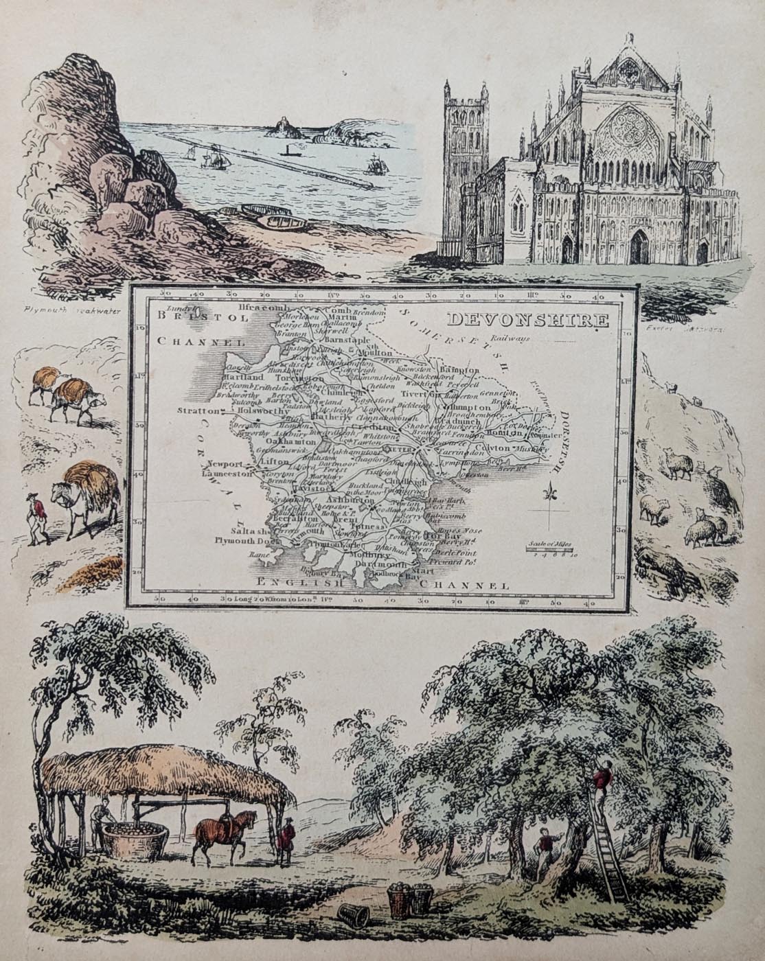
Antique Pictorial Map of Devon, 1845
Purchase this antique map
£130.00
Reuben Ramble, 1845
Original nineteenth-century pictorial antique map of Devon, published in 1845, with attractive early hand colouring and decorative illustrated borders.
Order number: 5022
Free UK Mainland Delivery
Antique map framing suggestions
About this Antique Map of Devon
This original antique map of Devon was published in 1845 as part of Reuben Ramble's Travels Through the Counties of England. Issued under the name Reuben Ramble, the work combined miniature county maps with decorative illustrations of the places, buildings and traditional activities associated with each county.
The map depicts the county of Devon, with its towns, roads and geographical features, surrounded by decorative illustrations of local landscapes, buildings, industries and rural activities. The pictorial border includes scenes associated with Devon, including Exeter Cathedral and Plymouth Breakwater.
This example retains its early hand colouring and is in folding condition as originally published. There is some age toning and strengthening to the centre fold, consistent with its age and original use.
Antique Map of Devon – Publication Details
- Title: Devon
- Author: Reuben Ramble (pseudonym of the Reverend Samuel Clark)
- Date: 1845
- Publication: Reuben Ramble's Travels Through the Counties of England
- Publisher: Darton and Clark (subject to verification)
- Colouring: Early hand colouring
- Image size: 200 x 160mm (approximately 8 x 6.25 inches)
- Condition: Minor age toning, with good paper and image. Centre fold strengthened.
- Order number: 5022
- Price: £130.00
Reuben Ramble's Pictorial Maps of England
Reuben Ramble's Travels Through the Counties of England was an unusual nineteenth-century geographical publication, combining county maps with decorative illustrations of local landscapes, buildings, industries and traditional activities.
The miniature maps were designed to make geography more engaging, with illustrated borders providing additional information about the character and attractions of each county. This decorative approach makes the Devon map particularly interesting to collectors of antique maps and historical topographical prints.
The Reverend Samuel Clark, who wrote under the pseudonym Reuben Ramble, produced a distinctive series of geographical works introducing the counties of England through maps and illustrations.
More Antique Maps of Devon
Explore our collection of original antique maps of Devon, including historic county maps from the seventeenth, eighteenth and nineteenth centuries.
Related Antique Map Collections
Frequently Asked Questions About the Reuben Ramble Map of Devon
Who was Reuben Ramble?
Reuben Ramble was the pseudonym of the Reverend Samuel Clark, also known as Sam Clark, who produced geographical publications about the counties of England.
When was the antique map of Devon published?
This example dates from 1845 and appeared in Reuben Ramble's Travels Through the Counties of England.
Is the Reuben Ramble map hand coloured?
Yes. This original example retains its early hand colouring, adding to the decorative appearance of the map.
What size is the antique map?
The printed map measures approximately 200 x 160mm, or 8 x 6.25 inches.
Where can I find other original antique maps of Devon?
Antique Maps Online offers a selection of original antique maps of Devon from the seventeenth to nineteenth centuries. Browse our antique maps of Devon to see the currently available collection.
Mon - Closed
Tues-Fri 10am-1.30pm, 2.30-5.30pm
Sat 10am-1.30pm
© Devonshire Fine Art
 Free UK Mainland Delivery*
9 Church Street
Modbury
Devon PL21 0QW. UK
01548 830872


