
Antique Map of Devonshire by Francis Sidney Weller, 1894
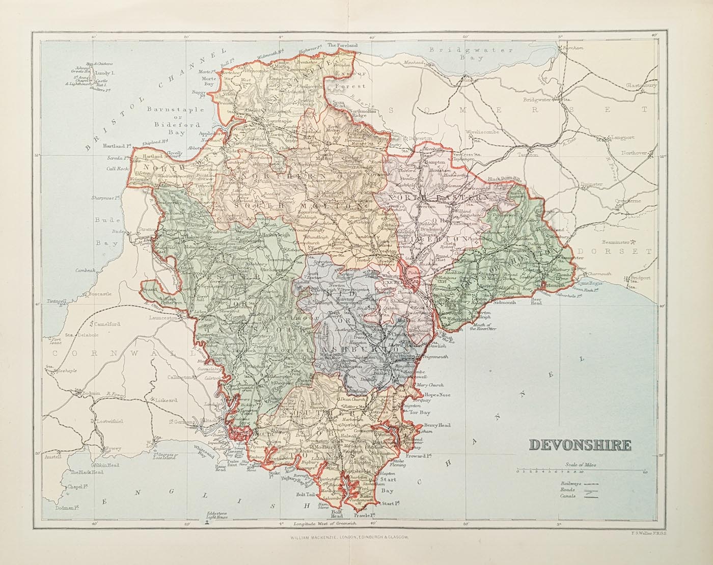
Antique Map of Devonshire by Francis Sidney Weller, 1894
This original antique map of Devonshire by Francis Sidney Weller dates from approximately 1894. Published by William Mackenzie as part of The Travelling Atlas of England and Wales, it provides a fascinating record of the county during the late Victorian period.
The map shows Devon's towns, roads and railway network, making it particularly interesting for anyone studying the historical development of transport and communications in the county. Its attractive presentation and detailed geographical information also make it suitable for collectors of antique maps of Devon.
Francis Sidney Weller and the History of the Map
Francis Sidney Weller (1849–1910) was an English engraver, lithographer and cartographer. He was the son of Edward Weller, a prominent map publisher, and became associated with the family's printing and publishing business.
The Weller family was connected with an established London map-publishing business which had previously been associated with cartographers and publishers including Sidney Hall. Francis Sidney Weller continued this family publishing tradition during the late nineteenth century.
The Comprehensive Gazetter of England and Wales. Edited by J H F Brabner, F.R.G.S.
This Devonshire map appeared in The Travelling Atlas of England and Wales, a publication showing the railway lines, roads, cities, towns, parks and country houses of England and Wales.
The railway network makes the map particularly interesting as a historical record of Devon during the late Victorian period, when railway connections were an important part of the county's economic and social development.
Details of the Antique Devonshire Map
- County: Devonshire
- Cartographer: Francis Sidney Weller
- Publisher: William Mackenzie
- Publication: The Travelling Atlas of England and Wales
- Date: Approximately 1894
- Subject: Devon towns, roads and railways
- Condition: Good imprint and paper, with minor age-related blemishes
- Price: £29.95
Collecting Antique Maps of Devon
Late nineteenth-century maps of Devonshire are particularly useful for understanding the development of the county's towns, transport routes and railway connections. They also provide an attractive historical record of the landscape before many subsequent changes to roads, settlements and infrastructure.
This map by Francis Sidney Weller offers an interesting example of Victorian county cartography and would make an appealing addition to a collection of antique maps of Devon.
Explore our wider collection of antique maps of Devonshire to discover further original maps of the county from the seventeenth to nineteenth centuries.
For presentation and preservation, see our antique map framing service.
Francis Sidney Weller (April 1849 - 1910) was an English engraver, lithographer, map publisher, and cartographer based in London. He was the son of Edward Weller (July 1, 1819 - 1884) and is named after another important map publisher, Sidney Hall. F. S. Weller took over his father's printing business in 1884. This is the same business that was founded by John Thomson, passed to Sidney Hall, who managed it from 1814 to 1831, then to his widow Selina Price Hall, who ran it to 1853, when it was taken over by his nephew Edward Weller, who ran it until 1884. Weller passed it to his son, Frances Sidney Weller.
Mon - Closed
Tues-Fri 10am-1.30pm, 2.30-5.30pm
Sat 10am-1.30pm
© Devonshire Fine Art
 Free UK Mainland Delivery*
9 Church Street
Modbury
Devon PL21 0QW. UK
01548 830872


