
Antique Map of Bath by Pieter Meijer, c.1763
Discover a scarce 18th-century antique map of Bath, Somerset, published by Pieter Meijer circa 1763. Titled Nieuwe Grondteekening van de Stad Bath, this Dutch engraved town plan includes a key of references and a scale. Measuring approximately 130 x 200 mm, the map is uncoloured and retains a collection stamp on the reverse. Priced at £255, it is an interesting piece for collectors of antique maps, Dutch cartography and the history of Georgian Bath.
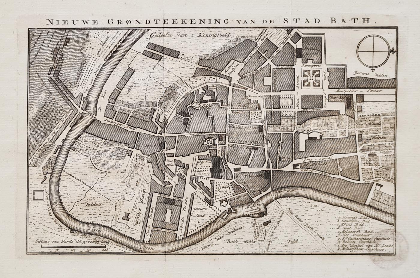
Nieuwe Grondteekening van de Stad Bath
Attribution: Pieter Meijer
Date: Circa 1763
Original title: Nieuwe Grondteekening van de Stad Bath
Publication: Algemeene Oefenschoole Van Kosten En Weetenschappen
Date: Circa 1763
Description: A scarce 18th-century Dutch map of Bath, Somerset, titled Nieuwe Grondteekening van de Stad Bath. The plan includes a key of references and a scale, providing detail about the historic city. The map was published in an uncoloured format, as issued.
Condition: Good paper and imprint. Uncoloured, with a collection stamp on the reverse. This is a folding map as published.
Image size: 130 x 200 mm (approximately 5 x 8 inches).
Price: £255.00
Order number: 4183
Antique map of Bath from the eighteenth century
This scarce eighteenth-century plan depicts Bath during the Georgian period, when the city was developing its reputation as a fashionable destination. The Dutch title, Nieuwe Grondteekening van de Stad Bath, identifies the map as a historic representation of the city.
The map includes a key of references and a scale. Its uncoloured appearance, folding format and collection stamp on the reverse are important details of this individual example. The image measures approximately 130 x 200 mm.
Explore more antique maps of Bath, browse antique maps of Somerset, or view our collection of antique town maps.
About Pieter Meijer and this antique map of Bath
This scarce antique map, titled Nieuwe Grondteekening van de Stad Bath, depicts the historic city of Bath in an 18th-century Dutch publication. Dated circa 1763, it is an example of the European interest in British towns and their geography during the Georgian period.
The map includes a key of references and a scale. Its original uncoloured appearance and collection stamp on the reverse are useful details for collectors assessing the individual sheet. The map measures approximately 130 x 200 mm.
Explore more antique maps of Bath, browse our antique maps of Somerset, or discover other antique city maps.
Frequently Asked Questions
Who published this antique map of Bath?
The map is attributed to Pieter Meijer and was published circa 1763.
What is the original title of the map?
Its Dutch title is Nieuwe Grondteekening van de Stad Bath.
Is the map coloured?
No. The map is described as uncoloured, with a collection stamp on the reverse.
What are the dimensions?
The image measures approximately 130 x 200 mm, or 5 x 8 inches.
How much does the map cost?
The listed price is £255.00, subject to availability.
Mon - Closed
Tues-Fri 10am-1.30pm, 2.30-5.30pm
Sat 10am-1.30pm
© Devonshire Fine Art
 Free UK Mainland Delivery*
9 Church Street
Modbury
Devon PL21 0QW. UK
01548 830872


