
Bristol by G. C. Ashmead 1871 with Hand Annotations for the Proposed Railway Network
Back to: City Maps | Antique City Maps of Bristol

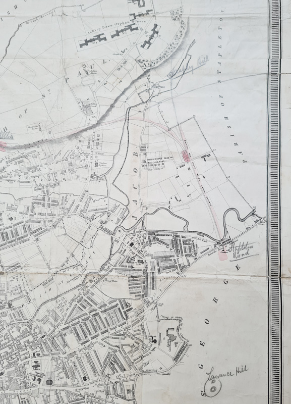

Title: ASHMEAD'S MAP OF THE CITY AND BOROUGH OF BRISTOL
Publication: G.C. Ashmead & Son, 11 Small Street, Bristol: March, 1871.
Date: 1871
Description: Reduced from the Original Survey and corrected to 1871. Fine engraved plan on three conjoined sheets, calligraphic title and table of references, Scale approx. 1" to 1 furlong. With Reference tables of Public Buildings, Schools, Almshouses, Dissenting Chapels, Principal inns and Hotels etc.
This unique version of the map is a more scarce undisected copy, which has been inscribed and annotated in pencil and watercolour, depicting proposed railway lines and stations for the city, some of which were ultimately never built! Quite possibly the original property of a Victorian railway engineer, as, at the bottom left there are some pencil costings relating to the proposed developments, in one case totalling over £42,000!
Condition: Steelplate line engraving with piano key border, folding copy with some repairs verso and age staining.
Image size: 925 x 835mm, 37 x 32.5" approx.
SOLD
Ashmead issued his first plan of Bristol in 1828. Based on the work of Joseph Plumley who died after only issuing the prospectus for his map. This first edition of Ashmead map measured 75" x 58" with a scale of 200 feet = 1 inch. Ashmead went on to issue smaller, reduced scale, plans of Bristol in 1833, 1846, 1855, 1871 and 1882. This edition extends from Windmill Hill to Cold Harbour Farm in the north, from the Black Swan on Stapleton Road to Nightingale Valley in the West.
Order No. 3423
19th century map of Bristol by Ashmead
Mon - Closed
Tues-Fri 10am-1.30pm, 2.30-5.30pm
Sat 10am-1.30pm
© Devonshire Fine Art
 Free UK Mainland Delivery*
9 Church Street
Modbury
Devon PL21 0QW. UK
01548 830872


