
Antique Map of Buckinghamshire by Joan Blaeu, c. 1645
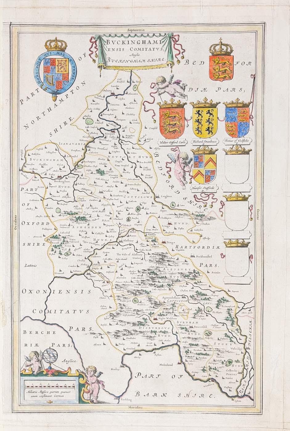
Explore this decorative 17th-century antique map of Buckinghamshire by Joan Blaeu, dating from approximately 1645 and featuring county heraldry and Latin text verso.
Map Details
- Mapmaker: Joan Blaeu
- County: Buckinghamshire, England
- Date: Circa 1645
- Map title: BVCKINGHAMI ENSIS COMITATVS Anglis BUCKINGHAMSHIRE
- Publication: Theatrum Orbis Terrarum, sive Atlas Novus
- Features: Decorative county heraldry
- Reverse: Latin text
- Condition: Bold imprint; professionally added margins and strengthening; some old creases in the margins; image unaffected
- Image size: 420 × 272 mm (approximately 16.5 × 10.7 inches)
- Price: £200.00
- Order number: 4670
Joan Blaeu's Antique Map of Buckinghamshire, c. 1645
This antique map of Buckinghamshire was published around 1645 as part of the Blaeu atlas tradition. It presents the historic English county in a decorative 17th-century cartographic style. The map is headed BVCKINGHAMI ENSIS COMITATVS Anglis BUCKINGHAMSHIRE.
The map is distinguished by its county heraldry and Latin text on the reverse. It offers collectors an early printed representation of Buckinghamshire and an attractive example of the decorative county mapping associated with the Blaeu family of map publishers.
Condition and dimensions
This example has a bold imprint and professionally added margins and strengthening. Some old creases are present in the margins, but the image is unaffected. The map measures approximately 420 × 272 mm (16.5 × 10.7 inches).
Price: £200.00.
Browse our antique maps of Buckinghamshire to discover other historical maps of the county, or explore our antique maps by Joan Blaeu. For presentation options, visit our antique map framing service.
Frequently Asked Questions
Who published this antique map of Buckinghamshire?
The map is attributed to Joan Blaeu and is associated with the Blaeu atlas publication tradition. See the publication details above for the information recorded for this example.
When was the map of Buckinghamshire published?
This map is dated approximately 1645.
The map has a bold imprint, professionally added margins and strengthening, and some old creases in the margins. The image is unaffected, according to the condition description for this example.
What are the dimensions of the map?
The image measures approximately 420 × 272 mm, or 16.5 × 10.7 inches.
Can this antique map be framed?
Yes. Explore our antique map framing options for further information.
Mon - Closed
Tues-Fri 10am-1.30pm, 2.30-5.30pm
Sat 10am-1.30pm
© Devonshire Fine Art
 Free UK Mainland Delivery*
9 Church Street
Modbury
Devon PL21 0QW. UK
01548 830872


