
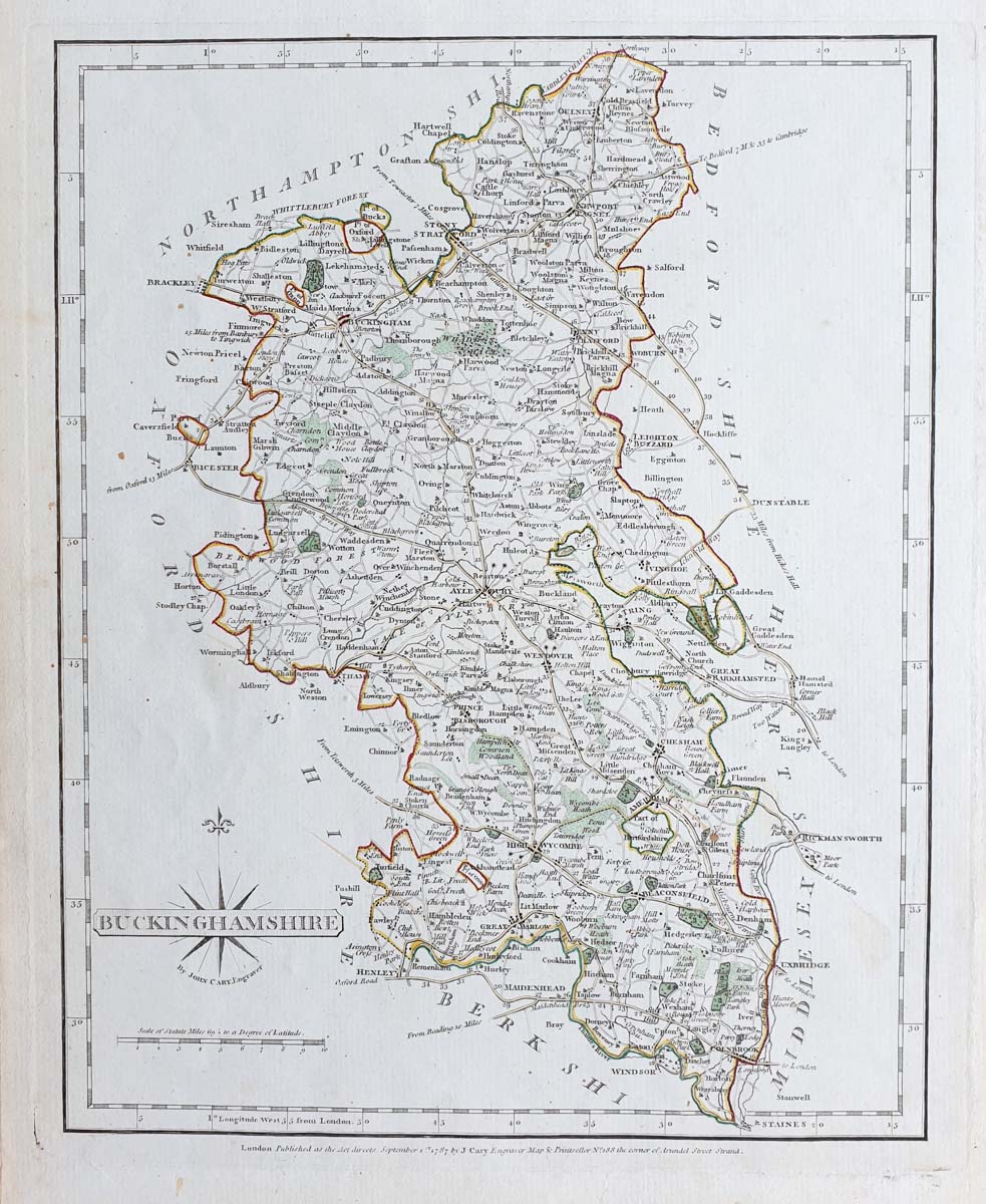
Antique Map of Buckinghamshire by John Cary, 1787
About Cary's Antique Map of Buckinghamshire
Published in 1787, this antique county map of Buckinghamshire is suitable for collectors of John Cary maps, historic maps of England and Buckinghamshire local history.
The map has early hand colouring and measures approximately 190 × 245 mm (8.25 × 10.25 inches, as supplied). It is an interesting piece for collectors of antique British county maps, Buckinghamshire history and Georgian-era cartography.
Condition and Dimensions
The map has a good imprint and paper, with some age discolouration and a minor crease to the bottom edge. The hand colouring is described as early. Please examine the product image and contact us if you require further condition details.
Map size: approximately 190 × 245 mm (7.5 × 9.65 inches).
Price: £35.00.
Reference: 3821.
Collecting Antique Maps of Buckinghamshire
John Cary's 1787 map offers collectors an example of late 18th-century county cartography. It may appeal to collectors of Buckinghamshire maps, Georgian history and antique maps of England.
View more antique maps of Buckinghamshire
Frequently Asked Questions
Who published this antique map of Buckinghamshire?
The map was published by John Cary on 1 September 1787 in Cary's New and Correct English Atlas.
How old is the map?
The map dates from 1787, making it approximately 239 years old in 2026.
What is the condition of the map?
The map has a good imprint and paper, some age discolouration, early hand colouring and a minor crease to the bottom edge.
Can the map be framed?
Framing options are available. Please see our antique map framing service for further information.
Mon - Closed
Tues-Fri 10am-1.30pm, 2.30-5.30pm
Sat 10am-1.30pm
© Devonshire Fine Art
 Free UK Mainland Delivery*
9 Church Street
Modbury
Devon PL21 0QW. UK
01548 830872


