
Antique Map of Cheshire by Robert Morden, c.1695
Back to: Cheshire | Robert Morden
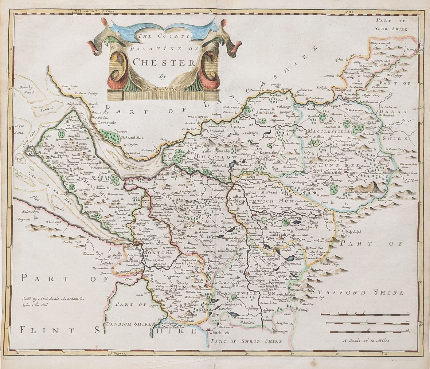
This original antique map of Cheshire was produced by the English mapmaker Robert Morden around 1695 and published in Camden's Britannia. Entitled The County Palatine of Chester, it depicts the historic county with its towns, settlements and decorative title cartouche. The map includes later hand colouring and is an attractive example of 17th-century English county cartography.
Details of the Antique Cheshire Map
Title: The County Palatine of Chester
Mapmaker: Robert Morden
Publication: Camden's Britannia
Date: Circa 1695
Description: Decorative 17th-century county map of Cheshire, including Chester, Stockport, Northwich, Sandbach and Macclesfield, with an ornamental title cartouche. Possibly a first edition.
Condition: Reasonable margins, folding copy as published, later hand colouring, some printer's marks and age discolouration to the margins.
Map size: 425 x 360mm (16.75 x 14 inches)
Price: £185.00
Reference: 4672
Robert Morden's 17th-century map of Cheshire
Robert Morden was one of the important English mapmakers of the late 17th century. His county maps were published in editions of William Camden's Britannia, a major historical and topographical work describing Britain. Morden's maps are valued for their detailed depiction of the English counties and their distinctive decorative features.
This map, entitled The County Palatine of Chester, shows Cheshire as it was understood in the late 17th century. It includes historic settlements such as Chester, Stockport, Northwich, Sandbach and Macclesfield, together with a decorative title cartouche. Its later hand colouring adds visual appeal, while the original folds and signs of age reflect its history as an antique printed map.
This original map is offered for sale for £185. It is suitable for collectors of antique maps, local history enthusiasts and those with an interest in the historical geography of Cheshire.
See more antique maps of Cheshire, browse our collection of Robert Morden maps, or explore our wider collection of antique maps of the British Isles.
Frequently Asked Questions
Who made this antique map of Cheshire?
The map was produced by Robert Morden, an English mapmaker whose county maps appeared in editions of Camden's Britannia.
When was the Cheshire map published?
It is dated circa 1695 and belongs to the late 17th-century period of English county mapmaking.
What places are shown on the map?
The map includes Chester, Stockport, Northwich, Sandbach and Macclesfield, as well as other Cheshire settlements.
Is the map hand coloured?
Yes. This example has later hand colouring, rather than colour applied at the time of its original publication.
Can the map be framed?
Yes. Framing options are available. Please see our antique map framing service for further information.
Mon - Closed
Tues-Fri 10am-1.30pm, 2.30-5.30pm
Sat 10am-1.30pm
© Devonshire Fine Art
 Free UK Mainland Delivery*
9 Church Street
Modbury
Devon PL21 0QW. UK
01548 830872


