
Antique Map of Devonshire by Robert K. Dawson, 1832
Explore more examples in our collection of antique maps of Devonshire, including maps from the seventeenth, eighteenth and nineteenth centuries. You can also find out more about our antique map framing service.
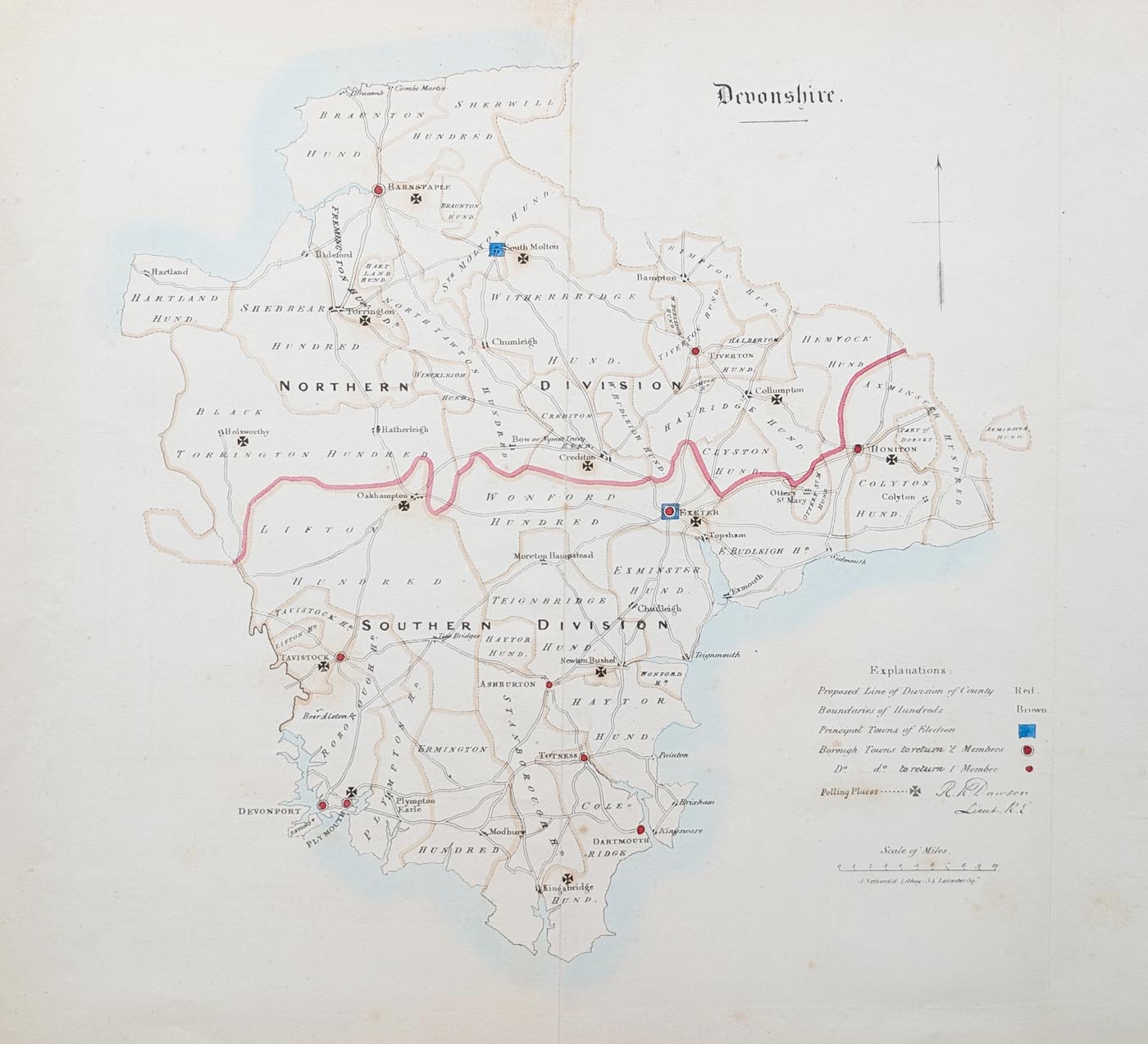
This original antique map of Devonshire was produced in 1832 by Lieutenant Robert Kearsley Dawson of the Royal Engineers. Titled Devonshire from the Ordnance Survey, it depicts the county divided into Northern and Southern divisions, with an explanatory key.
The map was published as part of the parliamentary reports concerning the proposed division of counties and the boundaries of boroughs. These reports formed part of the political and administrative changes being considered around the time of the 1832 Reform Act.
Printed as an antique lithograph and engraved by J. Gardner, the map retains its original outline hand colouring. Its historical subject makes it an interesting item for collectors of Devon maps, Ordnance Survey history and early nineteenth-century British political history.
This early Ordnance Survey map of Devonshire is particularly interesting because it records proposed administrative and electoral boundaries during an important period of nineteenth-century parliamentary reform.
Details of this Antique Map of Devonshire
Map title: Devonshire from the Ordnance Survey
Cartographer: Lieutenant Robert Kearsley Dawson, Royal Engineers
Engraver: J. Gardner
Publisher: Ordnance Survey
Date: 1832
Technique: Lithograph
Colour: Original outline hand colouring
Subject: Proposed division of Devonshire into Northern and Southern divisions
Image size: 275 x 245 mm (approximately 10.75 x 9.75 inches)
Condition: Some age toning and offsetting to the paper, with a bold imprint and early hand colouring.
Price: £50.00
Order number: 5021
Historical Background: Devon and the 1832 Reform Act
The 1832 Reform Act brought important changes to parliamentary representation in England and Wales. Before the reform, some small boroughs returned Members of Parliament despite having relatively small electorates, while growing industrial towns were often under-represented. The proposed division of counties and the definition of borough boundaries were therefore important subjects of parliamentary discussion.
This map of Devonshire belongs to that period of political change. Its division of the county into Northern and Southern sections, together with its explanatory key, makes it a useful historical document for anyone interested in the administration, electoral geography and history of Devon in the early nineteenth century.
Who produced the 1832 map of Devon?
The map is associated with Lieutenant Robert Kearsley Dawson of the Royal Engineers. It was engraved by J. Gardner and published by the Ordnance Survey.
What does the 1832 map of Devon show?
The map shows Devonshire divided into Northern and Southern divisions, with an explanatory key. It relates to parliamentary reports concerning proposed county divisions and borough boundaries.
Is the map hand coloured?
Yes. This example is described as an antique lithographic map with original outline hand colouring.
How large is the original map?
The image measures approximately 275 x 245 mm (10.75 x 9.75 inches).
Mon - Closed
Tues-Fri 10am-1.30pm, 2.30-5.30pm
Sat 10am-1.30pm
© Devonshire Fine Art
 Free UK Mainland Delivery*
9 Church Street
Modbury
Devon PL21 0QW. UK
01548 830872


