
Devon by Benjamin Donn
Back to: Antique Maps of Devon

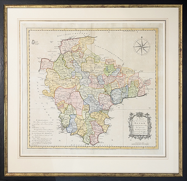
Key map
Title: A Map of the County of Devon with the City and County of Exeter Delineated form an Actual Survey by Benjamin Donn. Engraved by Thom's Jefferies, Geographer to His MAJESTY.
Publication: for The Royal Society for the Encouragement of Arts (later known as The Royal Society of Arts).
Date: 1765
Description: This magnificent, prize winning wall map on twelve sheets, is available with the separate key map, which is often missing. In 1759 the The Royal Society for the Encouragement of Arts offered an annual award of £100 for the best original 1 inch to 1 mile county survey. Donn secured the successful entry over Isaac Taylor's map of Dorset. Benjamin Donn was born in Bideford, North Devon and was a mathematician, surveyor and mathematics teacher. Donn's map is graticuled (a graphical depiction of a co-ordinate system as a grid of coordinate curves or lines), has a vignette title, inset plans of Exeter, Plymouth, Stoke Town, and Plymouth Dock and has an inset of Lundy to the top left. He was the first to annotate Burgh Island in Bigbury Bay as Bur or Borough, previously referred to as St. Michael's.
Surveyed from 1759 to Sept. 1763 and published in 1765 in several different formats. Loose leaves on paper, laid on linen and some on velum. All of these formats were available coloured or uncoloured. The engraving was untertaken by Thomas Jefferies. Donn decided to fund the survey and production of the map, which cost around £2000, by inviting subscriptions. By the time the map was published the subscriber's names numbered 528 and 750 subscribed copies were sold.
Condition: Laid on linen, hand coloured, some creasing and age toning. Each sheet is framed in a narrow black moulding, using UltraView glass and conservation backboard.
Image sizes: 1960 x 2080mm, 77 x 81" overall (slight gaps between frames when hung), each sheet 600 x 460, 24 x 18", key map image size 500 x 560mm, 19.75 x 21", approx.
Price: SOLD
Order No. 3900
Click here for framing suggestions
18th century, large wall map of Devon by Benjamin Donn
Watch the video:
Mon - Closed
Tues-Fri 10am-1.30pm, 2.30-5.30pm
Sat 10am-1.30pm
© Devonshire Fine Art
 Free UK Mainland Delivery*
9 Church Street
Modbury
Devon PL21 0QW. UK
01548 830872


