
Antique Map of Devon by George Augustus Walpoole, 1784
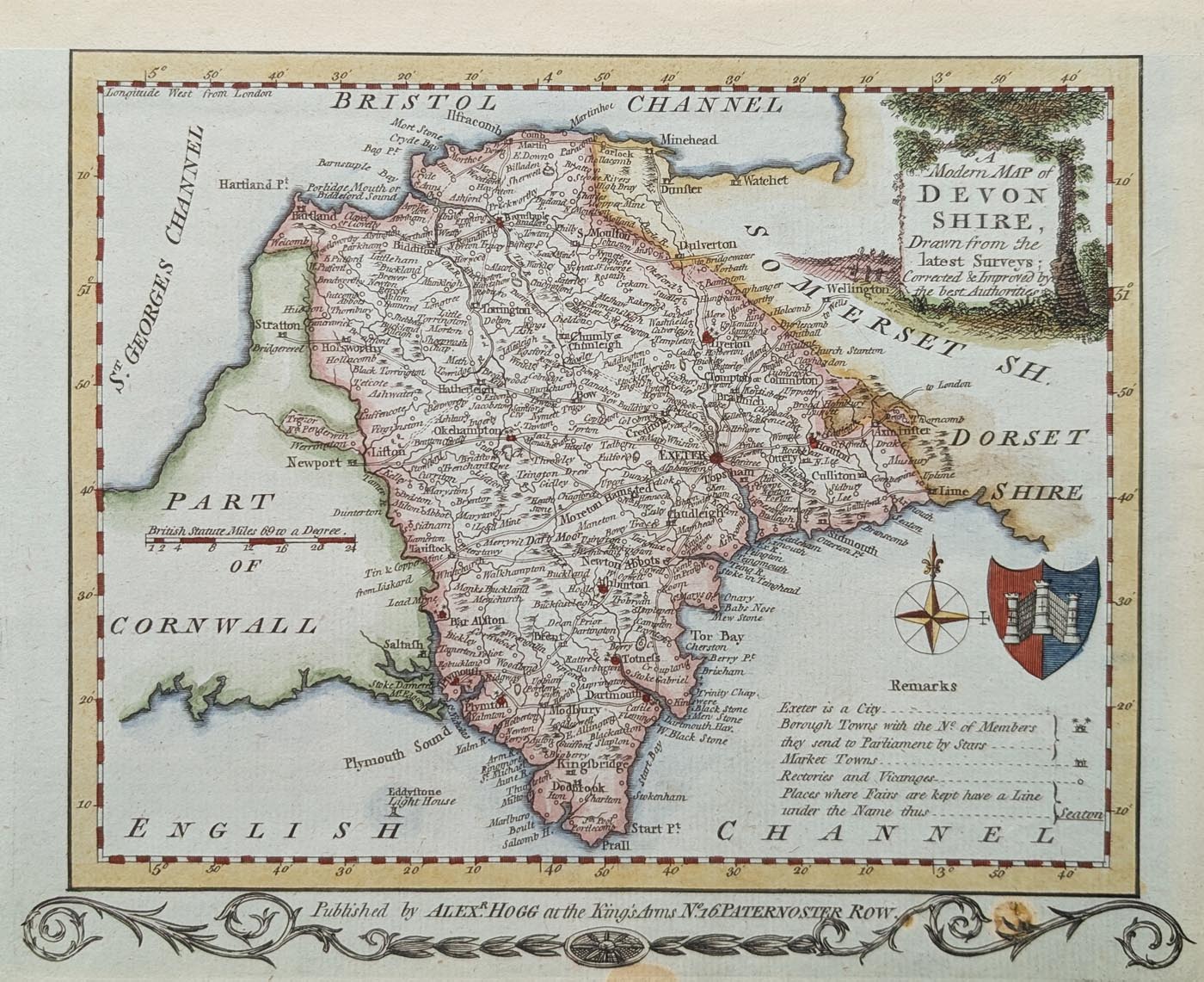
Antique Map of Devonshire, 1784
Title: A Modern Map of Devonshire, Drawn from the Latest Surveys; Corrected and Improved by the Best Authorities.
Publication: The New British Traveller, published by Alexander Hogg, London.
Date: 1784
Cartographer: George Augustus Walpoole.
Engraver: Thomas Conder.
Description: Attractive late eighteenth-century map of Devonshire, first edition, featuring a key and coat of arms in the bottom right corner. The map has a decorative title cartouche and engraved details.
Condition: Later hand colouring, good paper and clear imprint. The top margin has been cropped to the border, with a later additional margin.
Image size: 162 x 197mm (approximately 6.4 x 7.75 inches).
Price: £75.00
Order number: 5023
Georgian Antique Map of Devon by Walpoole and Hogg
George Augustus Walpoole was a British topographer associated with The New British Traveller, published in 1784. This substantial geographical work was prepared with assistance from a society of gentlemen and included a collection of maps of the English and Welsh counties.
The atlas contained 23 plates, many featuring two county maps, with some containing four. The maps were presented with decorative engraved scrollwork and other ornamental details.
This antique map of Devon is an attractive example of late eighteenth-century county cartography. It was engraved by Thomas Conder and published by Alexander Hogg in London. The decorative title cartouche, key and coat of arms add to its visual appeal.
The Devon map was printed beneath Cornwall, and this separate example lacks the upper decorative scroll. Despite this, it remains an interesting and decorative historical map of Devonshire, dating from 1784.
Browse our collection of antique maps of Devon to discover other original maps of the county from the seventeenth to nineteenth centuries.
Frequently Asked Questions About Antique Maps of Devon
Who made the 1784 antique map of Devon?
The map was produced by George Augustus Walpoole and engraved by Thomas Conder. It was published by Alexander Hogg in London as part of The New British Traveller.
When was this antique map of Devon published?
The map dates from 1784 and is an example of late eighteenth-century British county cartography.
Is the Devon map hand coloured?
Yes. This example has later hand colouring, adding decorative appeal to the original engraved map.
What are the dimensions of the map?
The printed map measures approximately 162 x 197mm.
Where can I buy antique maps of Devon?
You can browse our collection of antique maps of Devon, featuring original maps from the seventeenth, eighteenth and nineteenth centuries.
Mon - Closed
Tues-Fri 10am-1.30pm, 2.30-5.30pm
Sat 10am-1.30pm
© Devonshire Fine Art
 Free UK Mainland Delivery*
9 Church Street
Modbury
Devon PL21 0QW. UK
01548 830872


