
Antique Map of Exeter by John Rapkin, circa 1851
Discover this decorative antique map of Exeter by John Rapkin, published circa 1851 by the London Printing and Publishing Company. This Victorian town plan features later hand colouring and engraved vignettes depicting Exeter Cathedral, the Guildhall, the River Exe and the city's historic streets. An attractive original 19th-century map for collectors of antique Devon maps, Exeter history and Victorian cartography.
Back to: Devon | John Rapkin | City Maps | antique maps of Exeter City
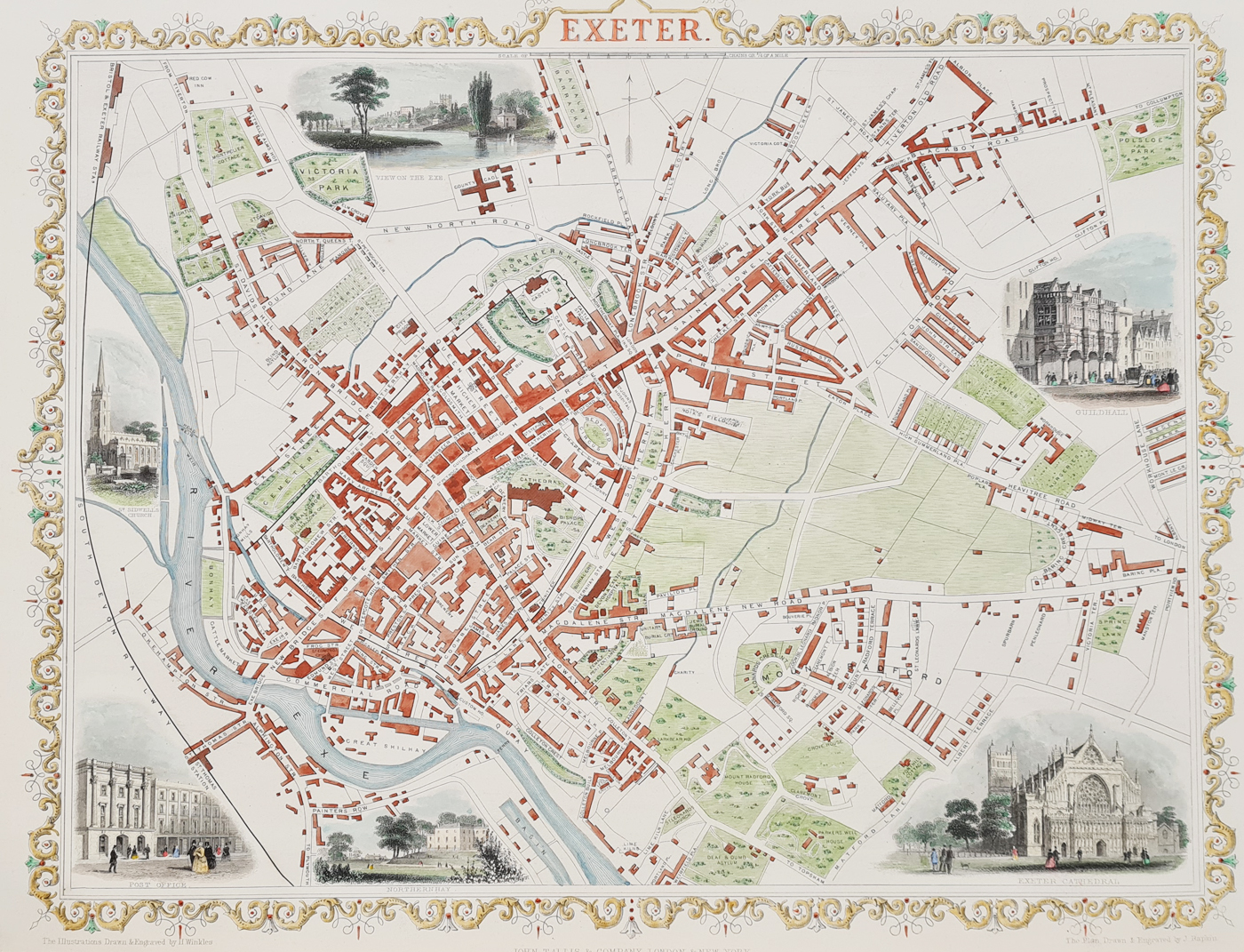
Exeter
Publication: The London Printing and Publishing Company
Date: c.1851
Description: Drawn and engraved by John Rapkin. Very decorative mid-Victorian plan with vignettes drawn and engraved by H. Winkles, including View on the Exe, Post Office, Guildhall, Exeter Cathedral.
Condition: Later hand colouring, scarce unfolded copy as published.
Image size: 265 x 360mm
10.5 x 14.25" approx.
£245.00
Order No. 4073a
Click here for framing suggestions
Antique Map of Exeter, Devon, by John Rapkin
This antique map of Exeter dates to circa 1851 and was published by the London Printing and Publishing Company. Drawn and engraved by John Rapkin, it presents a decorative Victorian view of the historic Devon city. The map combines a town plan with engraved illustrations that add architectural and local interest.
Decorative Engraved Views of Exeter
The surrounding vignettes include Exeter Cathedral, the Guildhall, the Post Office and a view on the River Exe. These illustrations make the map particularly appealing to collectors interested in Exeter's architectural heritage and the history of Devon.
John Rapkin and the Illustrated Atlas
John Rapkin was a 19th-century map engraver associated with the decorative maps published for John Tallis and Company. His work is known for combining geographical information with ornamental borders and illustrative views. Maps from this period offer an insight into how British towns were represented in Victorian publishing.
Condition and Dimensions
This example has later hand colouring and is described as a scarce unfolded copy, as published. The image measures 265 x 360 mm (approximately 10.5 x 14.25 inches). Please refer to the product photographs for details of the map's appearance and condition.
Buying This Antique Exeter Map
This 19th-century Exeter town plan is suitable for collectors of antique maps, local history enthusiasts and those seeking a decorative historical map of Devon. The map can be purchased unframed, with framing options available through our map framing service.
Explore more examples in our collection of antique maps of Exeter , or browse our wider selection of antique maps of Devon.
Mon - Closed
Tues-Fri 10am-1.30pm, 2.30-5.30pm
Sat 10am-1.30pm
© Devonshire Fine Art
 Free UK Mainland Delivery*
9 Church Street
Modbury
Devon PL21 0QW. UK
01548 830872


