
Antique Map of Guernsey, circa 1831 – Creighton & Walker
Explore our collection of antique maps of the Channel Islands | antique maps of the British Isles.
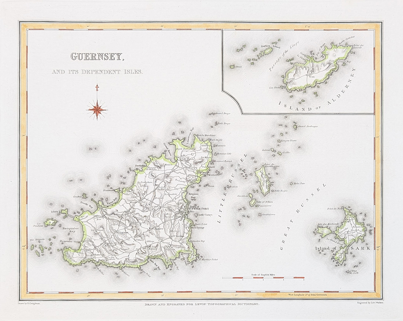
Antique map of Guernsey by Creighton and Walker, circa 1831
This attractive antique map of Guernsey dates from circa 1831 and was published in Lewis's Topographical Dictionary. The map is associated with Robert Creighton and the engraving and publication work of John and Charles Walker, well-known 19th-century mapmakers and publishers.
The map depicts the Channel Island of Guernsey together with neighbouring islands, including Sark and Alderney. Named locations include St Peter Port, providing an interesting historical record of the island's geography in the early 19th century.
The map has later hand colouring, giving added visual interest to the engraved detail. It is an attractive original historical map for collectors of antique Channel Islands maps, Guernsey history and 19th-century British topography.
This antique Guernsey map is from Lewis's Topographical Dictionary. The paper is in good condition with a bold imprint and minor age-related blemishes.
Guernsey antique map – details
- Cartographer: Robert Creighton
- Engraver/publisher: John and Charles Walker
- Publication: Lewis's Topographical Dictionary
- Date: Circa 1831
- Subject: Guernsey and neighbouring Channel Islands
- Colouring: Later hand coloured
- Condition: Good paper, bold imprint, minor age-related blemishes
- Image size: 210 x 270mm (approximately 8.25 x 10.5 inches)
- Order number: 4832
- Price: £39.95
This antique Guernsey map is from Lewis's Topographical Dictionary. The image measures approximately 210 x 270mm. The paper is in good condition with a bold imprint and minor age-related blemishes.
Historical maps of Guernsey and the Channel Islands
Guernsey has a long history as one of the principal Channel Islands, situated in the English Channel close to the Normandy coast of France. Its geographical position has made the island an important subject for cartographers and mapmakers for centuries.
Nineteenth-century maps of Guernsey record the island's towns, settlements and surrounding coastline before modern mapping and development. This circa 1831 map by Creighton and Walker is an interesting example of early Victorian topographical cartography.
Explore our collection of antique maps of the Channel Islands for further historical maps of Guernsey, Jersey, Sark and neighbouring islands.
Frequently Asked Questions
Who made this antique map of Guernsey?
The map is associated with Robert Creighton and John and Charles Walker. It was published in Lewis's Topographical Dictionary.
When was the Guernsey map published?
The map dates from approximately 1831, making it an early 19th-century representation of Guernsey and the surrounding Channel Islands.
Which islands are shown on the map?
The map focuses on Guernsey and includes references to neighbouring islands such as Sark and Alderney.
Is the Guernsey map hand coloured?
Yes. The map has later hand colouring, which adds visual interest to the original engraved detail.
What are the dimensions of the antique map?
The image measures approximately 210 x 270mm, or 8.25 x 10.5 inches.
antique maps of the British IslesMon - Closed
Tues-Fri 10am-1.30pm, 2.30-5.30pm
Sat 10am-1.30pm
© Devonshire Fine Art
 Free UK Mainland Delivery*
9 Church Street
Modbury
Devon PL21 0QW. UK
01548 830872


