
Cassell’s Immense or Monumental Map of London 1866 by Weller and Dower
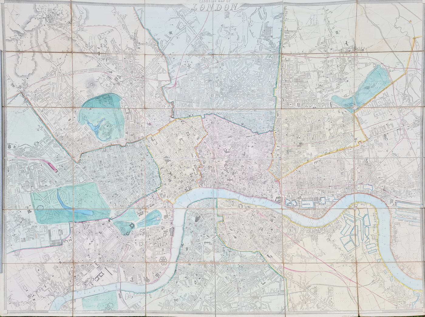
This exceptionally large antique map of London, known as Cassell’s Immense or Monumental Map of London, was published in 1866 by Cassell, Petter & Galpin. The map was produced by Edward Weller and engraved by John Dower, and is an impressive Victorian wall map showing the streets, parks, railways and principal buildings of London. It is original, later hand coloured and measures approximately 56 x 77 inches.
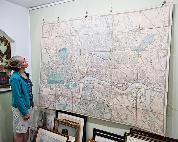
Karen demonstrating the scale of this impressive map.
Cassell's Immense Map of London 1866
This very large and detailed Victorian map of London was published by Cassell, Petter & Galpin in 1866. It was drawn by Edward Weller and engraved by John Dower.
The map shows the streets, parks, railways and important buildings of London, with original hand colouring used to distinguish different postal areas.
. The map was revised and corrected from the earlier version published in the Weekly Dispatch.
Key Details
- Title: Cassell's Immense or Monumental Map of London
- Date: 1866
- Publisher: Cassell, Petter & Galpin
- Cartographer: Edward Weller
- Engraver: John Dower
- Location: London
- Technique: Engraved map with original hand colouring
- Size: Approximately 56 x 77 inches (1440 x 1955 mm)
- Condition: Dissected and laid on linen. Folding copy with some wear at the folds and reinforcement to the verso, with two areas of minor loss. Scarce.
- Order number: 3935
Cassell's Immense Map of London 1866 for Sale
Price: £2,850.00
An exceptionally large original Victorian wall map of London, measuring approximately 56 x 77 inches.
Order No. 3935
Free UK mainland delivery.
About Cassell's Immense Map of London
Cassell's Immense or Monumental Map of London is a substantial Victorian map of the capital associated with Edward Weller and John Dower. An earlier version was published in the Weekly Dispatch on nine separate sheets in 1861–62. The 1866 edition was revised and corrected and included numerous additional street names and improvements.
Its exceptionally large format makes this an impressive example of a nineteenth-century London wall map. The map records London's streets, railways, parks and important buildings during a period of considerable expansion and change.
Explore our complete collection of antique maps of London, including historic maps of the city from the seventeenth to nineteenth centuries.
Edward Weller and John Dower
Edward Weller was responsible for the cartography of this large map of London, while John Dower was the engraver. The map was published by Cassell, Petter & Galpin and represents London during the Victorian period of rapid urban growth and railway development.
Mon - Closed
Tues-Fri 10am-1.30pm, 2.30-5.30pm
Sat 10am-1.30pm
© Devonshire Fine Art
 Free UK Mainland Delivery*
9 Church Street
Modbury
Devon PL21 0QW. UK
01548 830872


