
Antique Map of London and Westminster 1840 by Creighton & Walker
This decorative antique map of London and Westminster dates from 1840 and was engraved by John and Charles Walker after a drawing by Robert Creighton. Published in Lewis's Topographical Dictionary, the map provides a detailed view of London, Westminster and Southwark and has later hand colouring.
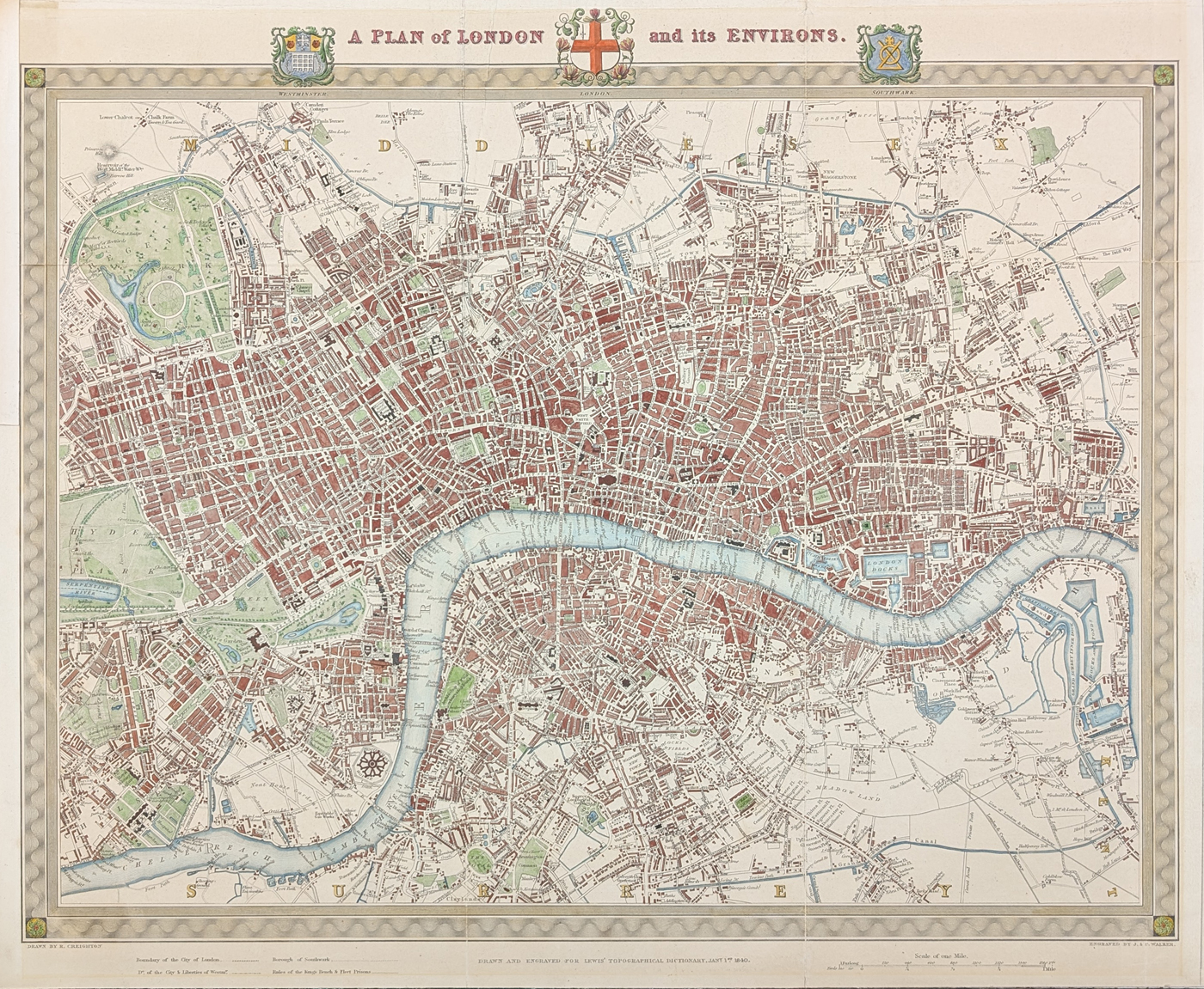
A Plan of London and its Environs
Publication: Lewis's Topographical Dictionary
Date: 1840
Cartographers: John and Charles Walker, after Robert Creighton
Description: Steel plate line engraving with a decorative border featuring the arms of Westminster, London and Southwark. Very detailed and decorative, with later hand colouring.
Condition: Good image, later hand colouring, folding copy laid on board, some marginal repairs and age toning. Priced accordingly.
Image size: 410 x 485mm (16 x 19.25" approx.)
Order No: 4711
Antique Map of London and Westminster, 1840
This detailed 1840 map depicts London, Westminster and Southwark and was produced for Lewis's Topographical Dictionary. The map was engraved by John and Charles Walker after a drawing by Robert Creighton and is distinguished by its decorative border and the arms of Westminster, London and Southwark.
The map provides a fascinating view of nineteenth-century London before many of the major changes that transformed the city later in the Victorian period. Its detailed engraving, decorative presentation and later hand colouring make it suitable for both collectors of antique maps and those interested in the historical development of London.
The map is a folding copy laid on board, with some marginal repairs and age toning, as described above. It measures approximately 410 x 485mm (16 x 19.25 inches).
John and Charles Walker and Robert Creighton
Produced in the reign of Queen Victoria, their maps have uncluttered clarity and are easy to read. The Walker brothers worked with a number of cartographers, including Robert Creighton.
John and Charles were the sons of John Walker Snr who worked for Alexander Dalrymple, Hydrographer to the East India Company in 1779 and for the Admiralty in 1795. John took over as hydrographer in 1808 and when he died Sir Francis Beaufort (wind force scale) was appointed. John the younger also became hydrographer to the East India Company in 1836. He and Charles continued the family firm until 1890.
Frequently Asked Questions
Who made this antique map of London?
The map was engraved by John and Charles Walker after a drawing by Robert Creighton.
What date is the London map?
Yes. This is an original nineteenth-century antique map, dated 1840.
Does the map show Westminster and Southwark?
Yes. The map depicts London, Westminster and Southwark and includes a decorative border featuring their respective arms.
Is this an original antique map?
Yes. This is a nineteenth-century antique map dating from 1840.
What are the dimensions of the map?
The image measures approximately 410 x 485mm (16 x 19.25 inches).
More Antique Maps of London
Mon - Closed
Tues-Fri 10am-1.30pm, 2.30-5.30pm
Sat 10am-1.30pm
© Devonshire Fine Art
 Free UK Mainland Delivery*
9 Church Street
Modbury
Devon PL21 0QW. UK
01548 830872


