
1741 Antique Map of London and the Surrounding Area by Homann Heirs

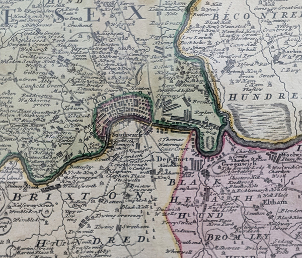
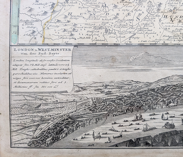
1741 Homann Heirs Map of London
£625.00
Order number: 4624
This original 1741 antique map of London and the surrounding area was published by the Homann Heirs, the German map-publishing firm established from the work of Johann Baptist Homann. The map provides a detailed view of the country surrounding London in the mid-18th century and is particularly attractive for its decorative engraving and coloured county boundaries.
The map covers a wide area around London, extending approximately from Luton in the north to Rayleigh in the east, Tadworth in the south and Maidenhead in the west. Hertfordshire, Essex, Kent, Surrey and Middlesex are distinguished by contrasting colours.
A decorative vignette depicting the River Thames and shipping appears beneath the main map, with London and Westminster identified below. The map was inspired by Thomas Bowles' earlier map, A New and Correct Map of Thirty Miles Around London.
This is an original 18th-century copperplate engraving rather than a modern reproduction. It would make an attractive addition to a collection of antique London maps, historical maps of England or 18th-century cartography.
Map Details
- Cartographer/Publisher: Homann Heirs
- Date: 1741
- Title: Regionis qvae circa Londinvm fpecialis repraefentatio geographica
- Area: London and surrounding counties
- Counties: Middlesex, Hertfordshire, Essex, Kent and Surrey
- Technique: Copperplate line engraving
- Image size: 505 × 565 mm (approximately 19.75 × 22.25 inches)
- Condition: Copperplate line engraving, folding copy as published.
- Order number: 4624
- Price: £625.00
Conservation Framing Available
Protect and display this original 1741 London map with our conservation framing service. We can advise on archival mounting, glazing and suitable frame styles for antique maps and works on paper.
Conservation framing for antique maps
See our complete collection of antique maps of London. You can also browse our antique maps of the British Isles and other antique city maps.
About Homann Heirs Maps
Johann Baptist Homann (1664–1724) was a German cartographer, engraver and publisher whose maps became widely known during the early eighteenth century. Following his death, the business continued under his successors and became known as the Homann Heirs.
The Homann Heirs continued publishing and issuing maps from the Homann publishing tradition, producing finely engraved maps of Europe, Britain and other parts of the world. Their maps are valued today for their historical information, decorative engraving and often elaborate cartouches and ornamentation.
Conservation Framing for this Antique London Map
This 1741 antique map of London can be professionally conservation framed to help protect and display the original engraving. Our conservation framing service is available for antique maps, historical maps and other works on paper. We can advise on suitable archival materials, glazing, mounts and frame styles to complement the map while helping to protect it from environmental damage.
For advice about framing this Homann Heirs map, please contact us to discuss the available conservation framing options.
Mon - Closed
Tues-Fri 10am-1.30pm, 2.30-5.30pm
Sat 10am-1.30pm
© Devonshire Fine Art
 Free UK Mainland Delivery*
9 Church Street
Modbury
Devon PL21 0QW. UK
01548 830872


