
Antique Map of New York City by John Rapkin, c.1851
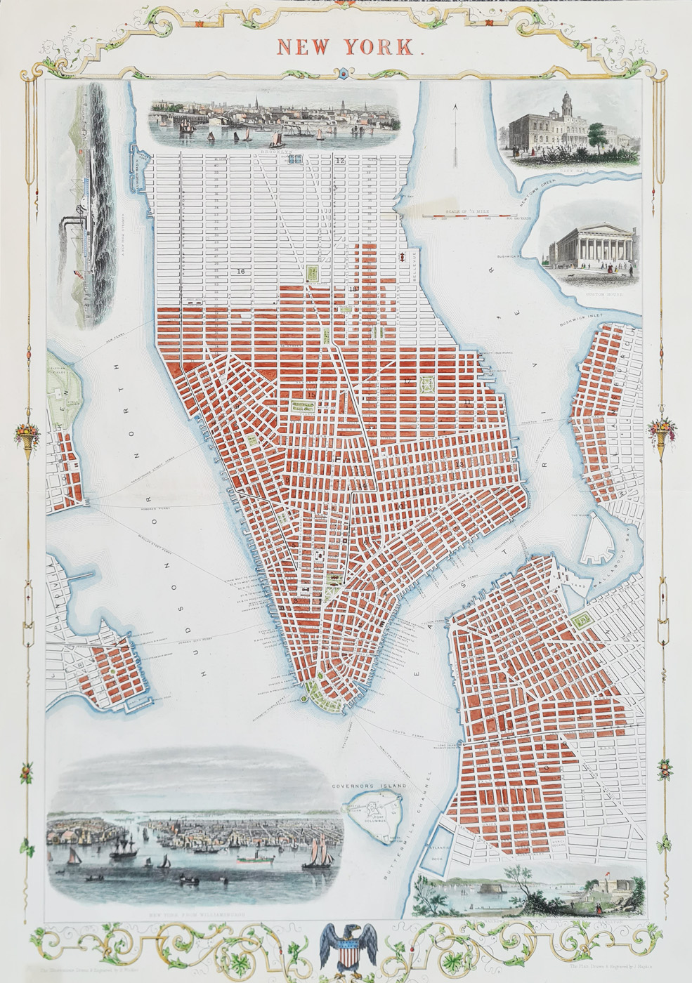
Original Antique Map of New York City, c.1851
Publication: John Tallis & Company London and New York
Date: c.1851
Description: Drawn and engraved by John Rapkin. Main features:
- Steel-plate line engraving with later hand colouring.
- Decorative engraved vignettes, including views identified as Brooklyn, City Hall, the Custom House, the Narrows from Fort Hamilton and New York from Williamsburg.
- Double-page format with characteristic decorative borders.
- A scarce example of mid-nineteenth-century city-map publishing.
Price: £895.00
Delivery: View delivery information
Framing: Explore framing options
Returns: Read our terms and returns policy
Order No. 4580
Antique Map of New York City, circa 1851
This decorative antique map of New York City was drawn and engraved by John Rapkin for publication by John Tallis & Company around 1851. It is an example of mid-nineteenth- century American city cartography, combining geographical detail with the elaborate engraved illustrations associated with Tallis's atlas maps.
The map features decorative vignettes depicting New York and its surroundings, including views associated with Brooklyn, City Hall, the Custom House, Fort Hamilton and Williamsburg. These illustrations give the map additional historical and visual interest beyond its geographical detail.
Engraved by John Rapkin, the map is notable for its characteristic decorative borders and steel-plate engraving. It is a collectible example of Victorian-era map publishing and an attractive addition to a collection of antique maps of New York, American city maps or nineteenth-century cartography.
Condition and Dimensions
This is a folding example as published, with later hand colouring. The paper and imprint are in good condition overall, with age-related marks. The map measures approximately 365 x 510 mm. Please consult the photographs for a closer view of its condition and colouring.
John Rapkin and Tallis's Illustrated Atlas
John Rapkin was a nineteenth-century mapmaker and engraver associated with the decorative maps published for Tallis's Illustrated Atlas of the World, issued around 1849–1853. These maps combine geographical information with detailed engraved borders and illustrative vignettes, making them particularly appealing to collectors.
This antique map of New York City, dated circa 1851, is offered for £895. Framing options are available, allowing the map to be displayed as a historical decorative print.
Explore more antique city maps or browse our collection of antique maps by John Rapkin.
Mon - Closed
Tues-Fri 10am-1.30pm, 2.30-5.30pm
Sat 10am-1.30pm
© Devonshire Fine Art
 Free UK Mainland Delivery*
9 Church Street
Modbury
Devon PL21 0QW. UK
01548 830872


