
London to St. Neots Antique Road Map by John Ogilby
Back to: Road Maps
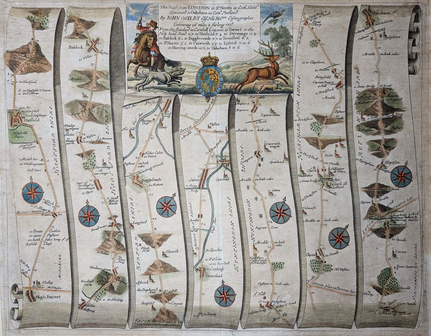
Title: The Road from LONDON to St. Neots Continued to Oakham, Rutland By JOHN OGILBY Esqr. His Ma.ties COSMOGRAPHER.
Publication: Ogilby Road Atlas
Date: c.1676
Description: 17th century strip road map depicting the road from Hatfield - High Barnet - St. Neots - Harringworth - Oakham. Page number 49.
Condition: Age discolouration, bold imprint. Later hand colouring.
Image size: 340 x 450mm
13.5 x 17.75"
approx.
£120.00
Order No. 4618
Seventeenth century road map of Lincolnshire by Ogilby.
John Ogilby (November 1600 – 4 September 1676)
Ogilby is regarded as one of the most important British cartographers since Christopher Saxton. Born in Edinburgh, he started his working life as a dance teacher, later changing career he became a tutor to the children of Lord Stafford. He established Ireland's first theatre on Dublin's Werburgh Street where he lived until the Irish Rebellion in 1641.
He nearly lost his life in the Irish troubles and returned to London penniless. After a period in Cambridge as a literary translator, he found favour at Court and was responsible for organising the Coronation Revels. On returning to Dublin he built his own theatre, which ultimately closed due to a dispute. This prompted a return to London where he started his business as a printer and publisher, sadly the premises were destroyed in the Great Fire of 1666.
After the fire, he was appointed as one of four 'sworn viewers', who were ordered to survey the parts of the city that had been destroyed, with a view to establishing the rights of land ownership in the devastated areas. The result of these surveys was a 1667 plan on a scale of 25” to the mile. Possibly as a result of this work, in 1674 Ogilby was appointed "His Majesty's Cosmographer and Geographic Printer". Encouraged by the King's interest in the project, he started preparations for his three volume work Britannia, Volume 1 contained a series of 100 strip maps depicting the roads of England and Wales.
This new atlas was probably the most important British cartographic achievement of the 17th century and was used as a source or reference by many subsequent publishers. Each of the strips carries a directional compass rose and distances are marked in miles and furlongs on a scale of 1” to the mile. They depict a remarkable amount of detail, including rivers, bridges, hills, county boundaries and unfenced roads. Ogilby can claim to to have established the Statute Mile of 1760 yards as the national unit of measurement. Until this publication, there were no less than three different length 'miles' in common use.
There was great demand for this atlas and two further editions were published in 1675 and another in 1698. All but the first edition were numbered in the bottom right hand corner. After the publication of Volume 1, Ogilby died in 1676 and was buried at St Bride's Church, one of Sir Christopher Wren's new London churches. Volumes 2 and 3 were never completed.
Publications include:
1670 – An Accurate Description and Complete History of Africa.
1670 to 1671- An Accurate Description and Complete History of America
1672 to 1673 - Maps of Kent and Middlesex
1673 - An Accurate Description and Complete History of Asia (Pt 1)
1675 to 1698 - Britannia a Geographical and Historical Description of the Principal Roads thereof.
1676-77 - Survey of London (with William Morgan)
1678 – Map of Essex (posthumously)
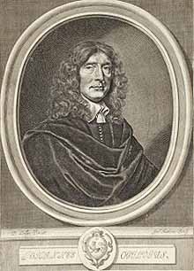
John Ogilby 1660 Portrait
Mon - Closed
Tues-Fri 10am-1.30pm, 2.30-5.30pm
Sat 10am-1.30pm
© Devonshire Fine Art
 Free UK Mainland Delivery*
9 Church Street
Modbury
Devon PL21 0QW. UK
01548 830872


