
Antique Map of the River Thames from Sheerness to London by James Gardener
This rare antique map shows the River Thames from Sheerness to London, with a detailed plan of His Majesty's Dockyard at Sheerness. Surveyed by James Gardener and dating from circa 1821, the map records the levels of the Thames and includes later hand colouring.
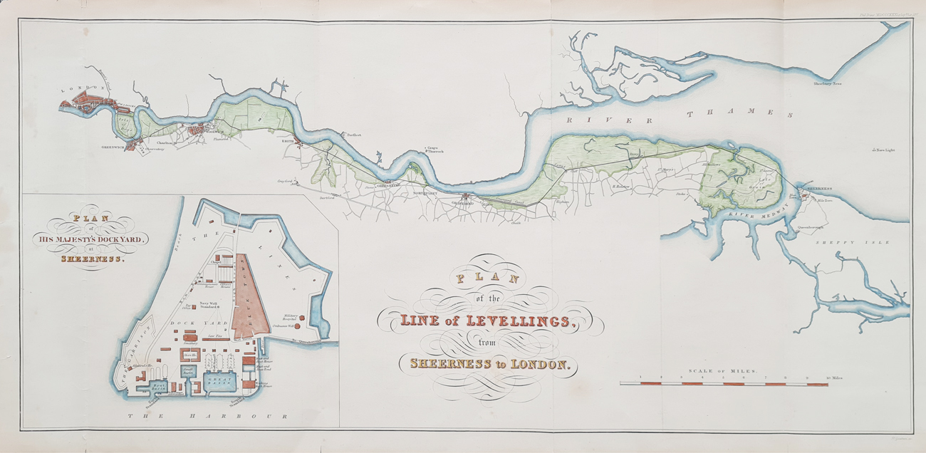
Plan of the Line of Levellings from Sheerness to London
Publication: 'Philosophical Transactions', Plate VI, p.197
Date: c.1821
Cartographer: James Gardener
Description: Detailed survey of the levels of the River Thames from Sheerness towards London, with a detailed plan of His Majesty's Dockyard at Sheerness.
Condition: Folding copy as published, later hand colouring, some chipping to edges. Very scarce.
Image size: 250 x 540mm (approximately 10 x 21.25 inches)
Buy the Antique River Thames Map
Order No: 3949
Price: £295.00
River Thames from Sheerness to London
This scarce nineteenth-century map records the River Thames between Sheerness and London as part of a detailed survey of river levels. Particularly notable is the detailed plan of His Majesty's Dockyard at Sheerness, an important naval establishment on the Thames Estuary.
The map provides a fascinating record of the Thames before the major changes that transformed London's riverfront and docklands during the nineteenth century. The combination of the river survey and detailed dockyard plan makes it of interest to collectors of antique maps, Thames history and naval history.
James Gardener
James Gardener was a map seller and publisher whose business was associated with the production and sale of maps and plans in London during the early nineteenth century. His maps and surveys provide an important record of the changing landscape of Britain during this period.
Frequently Asked Questions
Who made this River Thames map?
The map is associated with James Gardener and shows the River Thames from Sheerness to London.
What date is the map?
The map is dated circa 1821.
Does the map show Sheerness Dockyard?
Yes. The map includes a detailed plan of His Majesty's Dockyard at Sheerness.
Is this an original antique map?
Yes. This is an original nineteenth-century map rather than a modern reproduction.
What is the size of the map?
The image size is approximately 250 x 540mm, or 10 x 21.25 inches.
Explore more antique maps of London, including historic maps of the River Thames and surrounding areas.
Mon - Closed
Tues-Fri 10am-1.30pm, 2.30-5.30pm
Sat 10am-1.30pm
© Devonshire Fine Art
 Free UK Mainland Delivery*
9 Church Street
Modbury
Devon PL21 0QW. UK
01548 830872


