
Vintage Admiralty Chart of Isles of Scilly Shipwrecks
This unusual vintage Admiralty chart depicts shipwrecks around the Isles of Scilly, including numerous recorded positions of historic ship and aeroplane wrecks. Originally based on surveys by Staff Captain W. F. Maxwell R.N., the chart was issued by the Admiralty Hydrographic Department and subsequently republished by Slim Macdonnell Ltd in 1975. Featuring more than 50 illustrations and inscriptions, it is a fascinating historical record of the waters surrounding the Scilly Isles and an unusual piece of maritime cartography. Available to buy from Antique Maps Online for £145.
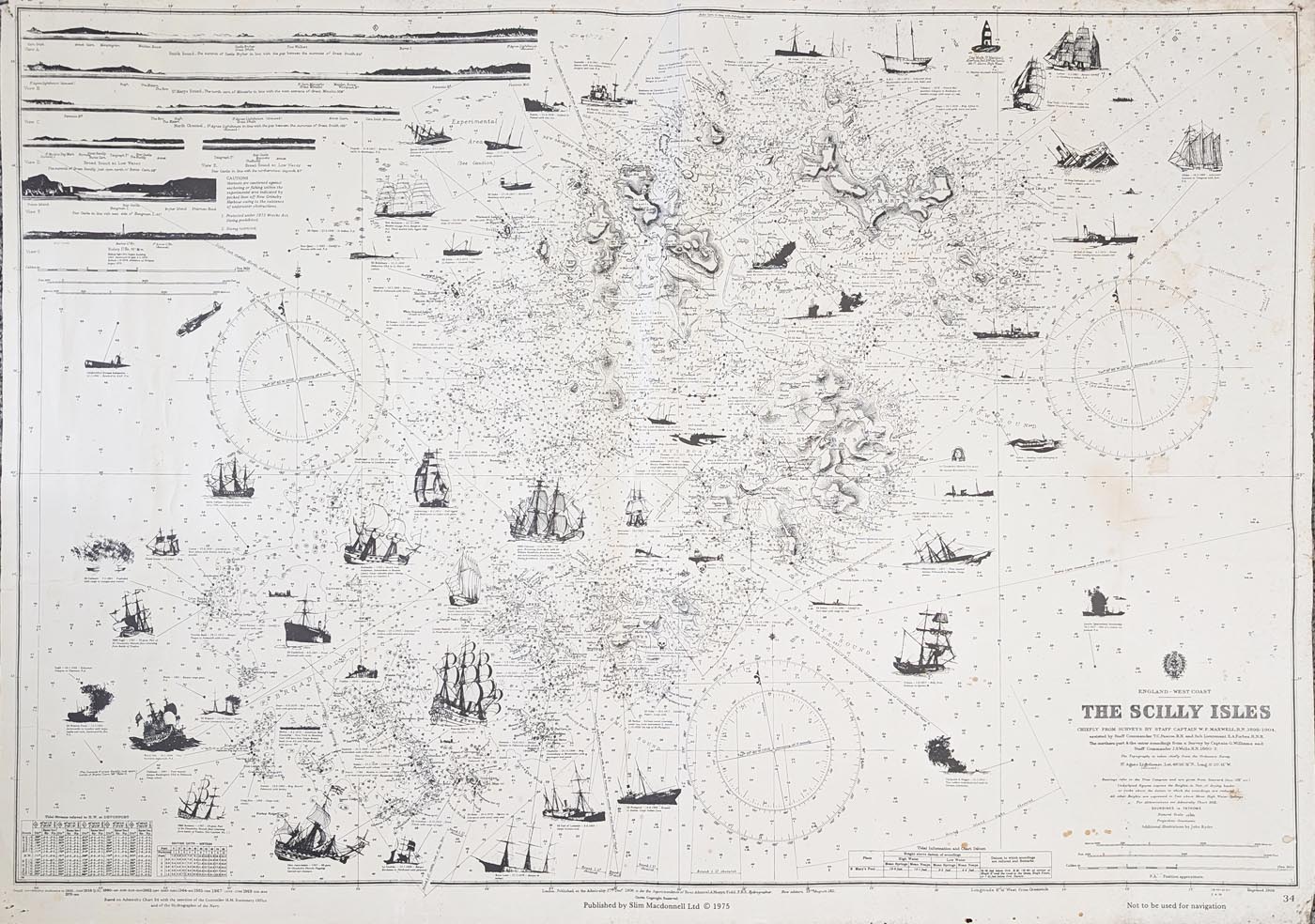
Vintage Admiralty Chart of the Isles of Scilly
Chart title: England West-Coast, The Scilly Isles
Publisher: Admiralty Hydrographic Department
Surveyor: Staff Captain W. F. Maxwell R.N.
Date: Based on Admiralty surveys of 1906; republished by Slim Macdonnell Ltd in 1975.
Description: Unusual vintage nautical chart showing the positions of numerous shipwrecks and aeroplane wrecks around the Isles of Scilly. Originally based on Admiralty surveys, with numerous additions and annotations, and republished by Slim Macdonnell Ltd in 1975. Includes over 50 illustrations and inscriptions, together with vignette elevations of prominent geographical features.
Condition: Uncoloured, with creases, some marginal blemishes, spotting and pinholes.
Image size: 790 × 1120mm (approximately 31 × 44 inches).
Price: £145.00
Reference: 4979
The Historic Shipwrecks of the Isles of Scilly
The Isles of Scilly lie off the south-western tip of Cornwall, where exposed Atlantic waters, rocky reefs and strong currents have made navigation challenging for centuries. The surrounding waters have witnessed numerous maritime disasters, leaving a remarkable record of shipwrecks around the islands.
This unusual vintage Admiralty chart is particularly interesting because it records the positions of shipwrecks and aeroplane wrecks around the Scilly Isles. It provides a fascinating insight into the maritime history of this area and the importance of hydrographic surveying in documenting navigational hazards.
Admiralty Surveys and the History of the Chart
The chart is associated with surveys undertaken by Staff Captain W. F. Maxwell R.N. and was published by the Admiralty Hydrographic Department. Numerous additions record the positions of wrecks, while vignette illustrations show elevations of prominent geographical features around the islands.
The example offered here was republished by Slim Macdonnell Ltd in 1975. Its large format, extensive annotations and more than 50 illustrations make it an unusual example of historical nautical cartography.
A Large and Unusual Vintage Nautical Chart
Measuring approximately 790 × 1120mm, this chart makes an impressive display piece for collectors of maritime history, Admiralty charts and historic maps of Cornwall and the Isles of Scilly.
This original vintage chart is available from Antique Maps Online for £145.00. Please see the product details above for information about its condition and dimensions.
Explore more examples in our collection of vintage Admiralty charts and antique sea charts. You can also browse our antique maps of Cornwall.
Frequently Asked Questions
What does the Isles of Scilly shipwreck chart show?
The chart records the positions of numerous shipwrecks and aeroplane wrecks around the Isles of Scilly, together with illustrations and inscriptions relating to the surrounding geographical features.
Who published the Admiralty chart?
It was issued by the Admiralty Hydrographic Department and subsequently republished by Slim Macdonnell Ltd in 1975.
How large is the chart?
The image measures approximately 790 × 1120mm, or 31 × 44 inches.
Is this an original Admiralty chart?
This is a vintage printed chart associated with Admiralty hydrographic surveys. The example offered here was republished in 1975, rather than being described as a chart printed in 1906.
What condition is the chart in?
The chart is uncoloured and has creases, some marginal blemishes, spotting and pinholes. Please refer to the product photograph and contact us if you require further condition information.
Mon - Closed
Tues-Fri 10am-1.30pm, 2.30-5.30pm
Sat 10am-1.30pm
© Devonshire Fine Art
 Free UK Mainland Delivery*
9 Church Street
Modbury
Devon PL21 0QW. UK
01548 830872


