
Wareham Dorset by Hutchins

Title: To John Calcraft Esq'r this Plan of Wareham is Humbly inscribed by the Author
Publication: John Hutchin’s History and Antiquities of the County of Dorset
Date: 1774
Description: Detailed town plan of Wareham in Dorset, depicts the River Trent and River Frome, top left is the Arms of Wareham anbottom centre is John Calcrafts coat of arms. Vol.1 p.35
Condition: Folding copy as published, later hand colouring. Scarce.
Image size: approx.
£125.00
Order No. 4951
Click here for framing suggestions
18th century Town plan of Wareham in Dorset
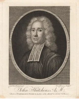
Rev. John Hutchins MA
This street map of the town of Wareham was published in the Rev. John Hutchin’s History and Antiquities of the County of Dorset, along with maps of several other towns. As the first detailed view of the ancient town and its layout, it depicts different periods of history. Established between two rivers, Wareham has the River Piddle (or North Trent) to the north and the River Frome to the south, occupying a strategic place at the entrance to Purbeck. Until the early medieval period, it was the main port of the harbour with ships sailing from the quay on the Frome. The most obvious feature revealed by the map was the regularity of its street plan, with the main north to south and east to west streets crossing each other at right angles near the centre of town. Within each quadrant of the town, a grid plan of streets was clear to see, believed to have been laid out in Saxon times.
Also depicted are the earthen banks, marked ‘town wall’ on the map, enclosing the town into a slightly elongated square. These were also built by the Saxons, probably dating from the time of Alfred the Great when he made Wareham a fortified town. They were topped at one time by stone walls, later robbed out for building stone. The banks were modified by mounds built at the northern corners, probably in the 17th century during the Civil War. In spite of these defences, Wareham was still vulnerable to attack and the town changed hands several times in both the Stephen and Matilda conflict of the mid 1100s and in the Civil War 500 years later. The destruction of the town in the 12th century together with the gradual silting up of the river channel, led to Wareham losing out to Poole as the principal local port.
Another sign of the importance of the town in antiquity was the number of churches shown on the map or indicated by street names. Unlike Poole, which had only one church until the 17th century, Wareham had seven or eight, although some were no longer in use by the date of the map. St. Martin’s on the bank near the northern entrance to the town and Lady St. Mary church were both of Saxon origins and Wareham Priory dated from at least the 12th century. The churches of St. John’s, St. Peter’s, St. Michael’s, Holy Trinity and All Hallows also had medieval origins.
The Rev. John Hutchins was Rector of Holy Trinity church, another church which was damaged and fell out of use after the fire. In fact the manuscript of his book narrowly escaped the flames and was saved by his wife who took what she could carry and went to stand in the River Frome to avoid the conflagration. His History, the result of decades of research, provided the basis for most future historical studies of Dorset. The author died in 1773, the year before the book was published.
Mon - Closed
Tues-Fri 10am-1.30pm, 2.30-5.30pm
Sat 10am-1.30pm
© Devonshire Fine Art
 Free UK Mainland Delivery*
9 Church Street
Modbury
Devon PL21 0QW. UK
01548 830872


