
Worcestershire by Christopher Saxton
Back to: Worcestershire
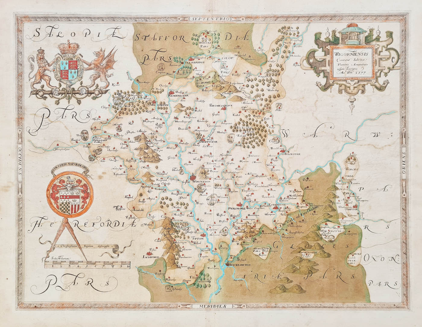
Title: Wigorniensis Comitatus
Publication: An Atlas of England and Wales
Date: c.1577
Description: The first county map of Worcestershire, very decorative, with coats of arms, dividers and scale. Saxton set the standard followed by many other map makers including John Speed and Joan Blaeu. Very scarce.
Condition: Folding copy as published, later hand colouring, some age toning, bold imprint, one minor closed split. Good condition for a map over 400 years old.
Image size: 370 x 490mm, 14.5 x 19.25" approx.
£1850.00
Order No. 4204
Click here for framing suggestions
Christopher Saxton's map of Worcestershire
Christopher Saxton c.1542-1610
Born near Dewsbury in Yorkshire. He was a surveyor by profession, although it is doubtful whether he would have had an opportunity to utilise his talents outside a monastic house had he been born a little earlier. Pre- Reformation, the church had been the principal land-owner in England and Wales and the monks had undertaken surveys and compiled detailed recordings of their holdings. After the dissolution of the monasteries most of these records were lost or destroyed.
The nature of Saxton's work involved travelling to various parts of the country and considerable personal contact with landowners, one of whom was Thomas Seckford, a Suffolk nobleman and a Master of Requests to Queen Elizabeth I. Saxton's proposal for the atlas was met with royal approval and subsequently commenced his survey in 1570 and first map were published in 1574. He was granted a ten-year licence to make and market maps in 1577. Saxton is widely regarded as the Father of English Cartography.
Mon - Closed
Tues-Fri 10am-1.30pm, 2.30-5.30pm
Sat 10am-1.30pm
© Devonshire Fine Art
 Free UK Mainland Delivery*
9 Church Street
Modbury
Devon PL21 0QW. UK
01548 830872


