
Antique Map of Devon by Thomas Johnson, 1847
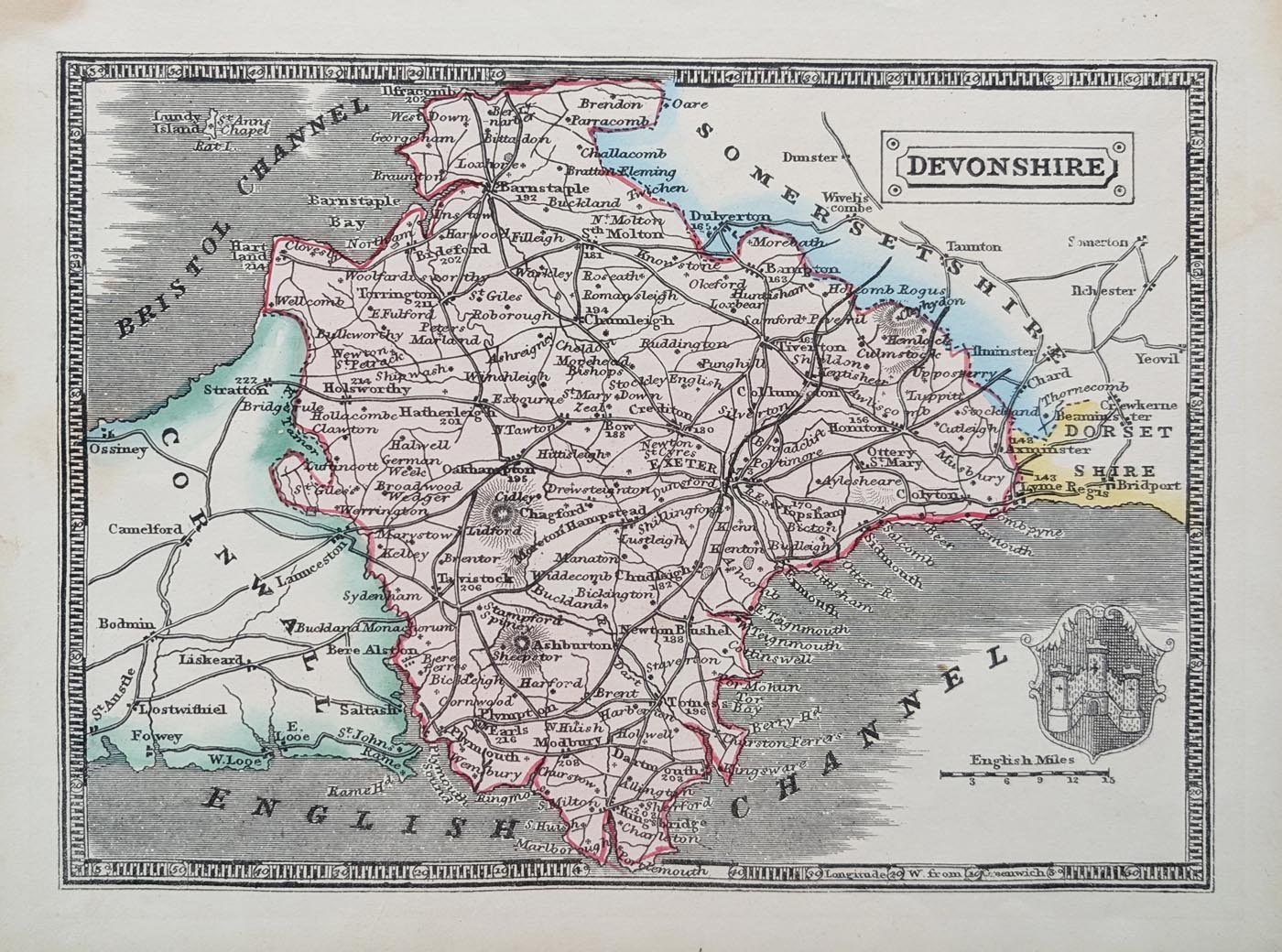
This scarce antique map of Devonshire was produced by Thomas Johnson in 1847, following a design originally created by Joshua Archer for William Pinnock's Guide to Knowledge in 1838.
Archer's original maps were issued as white-line engravings on black backgrounds. However, technical difficulties in producing satisfactory prints meant that this unusual format proved unpopular and production was abandoned.
Later editions returned to the more conventional black engraving on a white background. This 1847 example was produced by Thomas Johnson as a woodcut print and has later hand colouring.
Map Details
Mapmaker: Thomas Johnson
Original design: Joshua Archer, 1838
Publication: William Pinnock's Guide to Knowledge, later issue
Date: 1847
Area shown: Devonshire, England
Decorative features: Exeter coat of arms
Towns shown: Exeter, Plymouth, Tavistock, Crediton, Dartmouth, Torquay, Brixham, Salcombe, Kingsbridge and Ivybridge.
Condition: Bold imprint and later hand colouring. Some marginal marks and blemishes.
Map size: 165 x 225mm (approximately 6.5 x 8.9 inches).
Order number: 5014
About this Antique Map of Devon by Thomas Johnson
This original antique map of Devonshire dates from 1847 and was produced by Thomas Johnson. Its history can be traced back to Joshua Archer's original design for William Pinnock's Guide to Knowledge, first issued in 1838.
Archer's original maps used an unusual white-line engraving technique, with the map appearing in white against a black background. Difficulties in obtaining satisfactory printed results led to this format being abandoned. Later issues returned to the more familiar black engraving on a white background, as seen in this example.
The map shows Devon's principal towns and settlements, including Exeter, Plymouth, Dartmouth, Tavistock and Torquay. The Exeter coat of arms provides an attractive decorative feature. This example is a woodcut print with later hand colouring.
Measuring approximately 165 x 225mm, this scarce nineteenth-century map offers an interesting combination of Devonshire history and unusual publishing history. It is an original antique map, not a modern reproduction.
Buying and Framing Your Antique Map of Devon
This map is available unframed or professionally framed. A choice of framing styles and glass options is available when ordering.
We offer free UK mainland delivery. For further information, see our map framing service and delivery information.
Explore more examples in our collection of antique maps of Devon.
Mon - Closed
Tues-Fri 10am-1.30pm, 2.30-5.30pm
Sat 10am-1.30pm
© Devonshire Fine Art
 Free UK Mainland Delivery*
9 Church Street
Modbury
Devon PL21 0QW. UK
01548 830872


