
Antique Map of Bath by Andrew Dury, c.1764–66
Discover a scarce 18th-century antique map of Bath, Somerset, published by Andrew Dury circa 1764–66. Entitled Plan of the City and Suburbs of Bath, this miniature engraved town plan offers a historic view of Bath and its surrounding suburbs. The map measures approximately 110 x 132 mm and features later hand colouring. Priced at £245, this original antique map is an appealing acquisition for collectors of Bath history, Georgian town plans and British cartography.
Back to: Somerset | Antique City Maps | Antique Maps of Bath
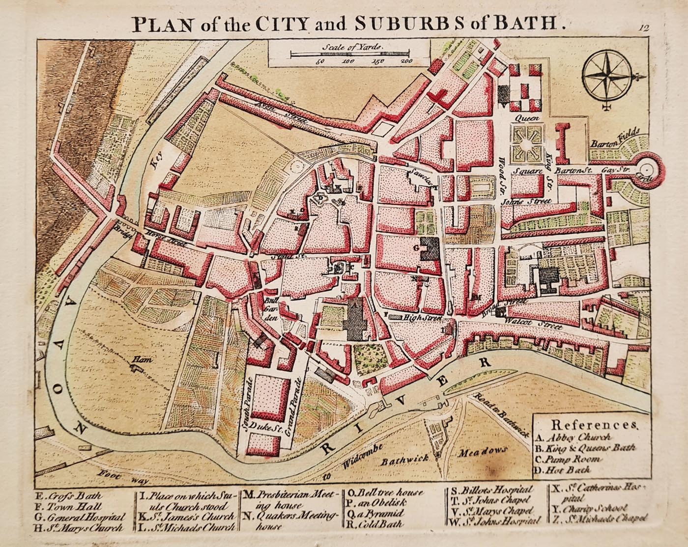
Plan of the City and Suburbs of Bath
Mapmaker: Andrew Dury
Date: Circa 1764–66
Publication: A Collection of Plans of the Principal Cities of Great Britain and Ireland, with Maps of the Coast of the Said Kingdoms.
Description: An 18th-century miniature engraved town plan of Bath, Somerset. The map is possibly engraved by John Cheevers and is based on surveys associated with John Rocque. A table of references appears at the bottom and the top right of the sheet, marked page 12.
Condition: Good paper and imprint, with minor spotting and age toning. Later hand colouring and a collection stamp are present on the verso.
Image size: 110 x 132 mm (approximately 4.25 x 5.25 inches).
Price: £245.00
Order number: 4185
Explore our antique map framing suggestions
Andrew Dury and 18th-century mapmaking
Andrew Dury (active circa 1760–1777) was a British map and print publisher based at Duke's Court, St Martin's Lane, London. His publications included maps of Britain and Ireland, geographical atlases and maps relating to international conflicts.
This scarce miniature plan of Bath belongs to the tradition of detailed British town mapping in the 18th century. Entitled Plan of the City and Suburbs of Bath, it records the historic city at a time when Bath was an important centre of Georgian urban life. Its engraved detail and reference table make it of interest to collectors of historical town plans and the cartographic history of Somerset.
Explore our collection of antique maps of Bath, browse our antique maps of Somerset, or discover more antique city maps.
Frequently Asked Questions
Who made this antique map of Bath?
The map is attributed to Andrew Dury, a British map and print publisher active during the 18th century.
When was the map of Bath published?
The map is dated circa 1764–66.
How large is this antique Bath map?
The image measures approximately 110 x 132 mm, or 4.25 x 5.25 inches.
What is the condition of the map?
The paper and imprint are described as good, with minor spotting and age toning. Later hand colouring and a collection stamp are present on the reverse.
How much does the antique map cost?
The antique map is priced at £245.00. You can use the purchase button on this page to place an order, subject to availability.
Other antique maps of Bath
A decorative 19th-century map of Bath by Thomas Moule
circa 1836-50
£145.00
View map

Bath from the Ordnance Survey with text
Robert K. Dawson Lieut. R.E.
1837
£59.00
View map

Mon - Closed
Tues-Fri 10am-1.30pm, 2.30-5.30pm
Sat 10am-1.30pm
© Devonshire Fine Art
 Free UK Mainland Delivery*
9 Church Street
Modbury
Devon PL21 0QW. UK
01548 830872


