
Antique Map of the East & West India Docks 1815 – Isaac Basire
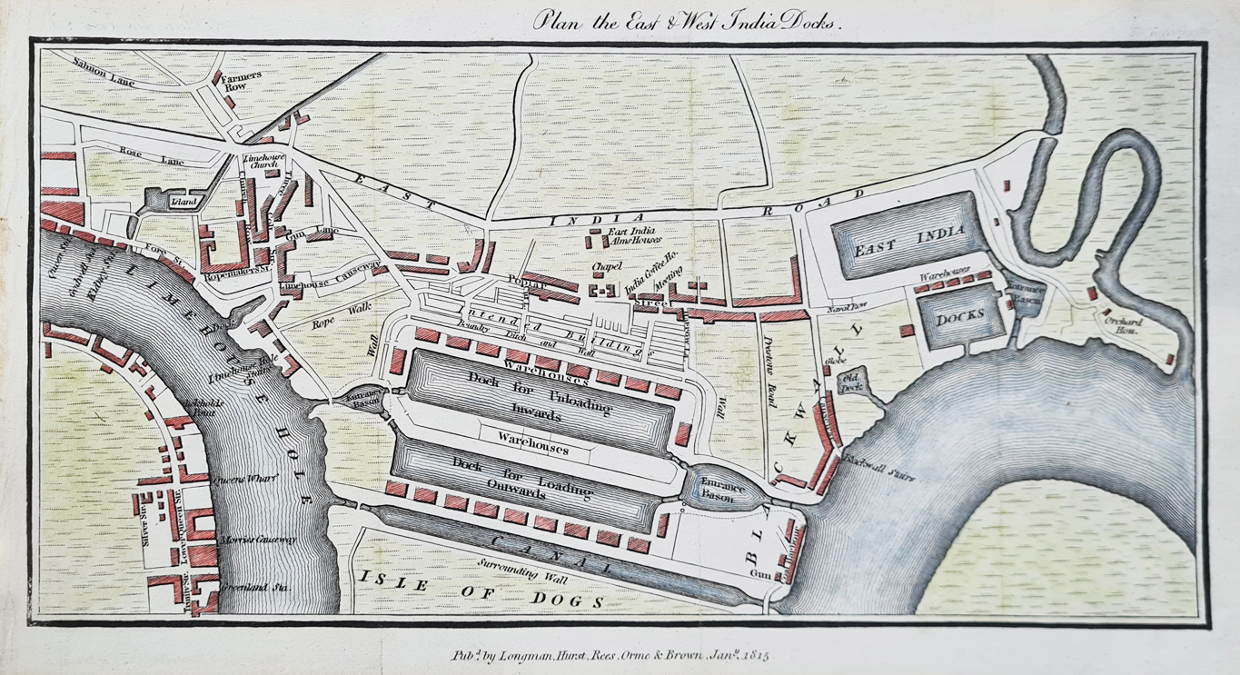
This antique map of the East and West India Docks in London dates from January 1815. The detailed plan shows the important commercial docks on the River Thames, including warehouses, proposed buildings and almshouses. The map is a copperplate engraving attributed to Isaac Basire and has been later hand coloured.
Antique Map of the East and West India Docks
This detailed early 19th-century plan depicts the East and West India Docks in London. The map shows the dock warehouses, proposed buildings and almshouses, providing a fascinating view of London's expanding commercial docklands in the early 19th century.
The map was published in January 1815 by Longman, Hurst, Rees, Orme, and Brown and is attributed to Isaac Basire. It is a copperplate engraving with later hand colouring.
Key Details
- Title: Plan of the East and West India Docks
- Date: January 1815
- Publisher: Longman, Hurst, Rees, Orme, and Brown
- Cartographer/engraver: Isaac Basire
- Location: East and West India Docks, London
- Technique: Copperplate engraving, later hand coloured
- Image size: 190 × 820 mm (7.5 × 32.25 inches) approximately
- Condition: Copperplate line engraving, bold imprint, later hand colouring
Antique Map of the East & West India Docks for Sale
Price: £120.00
Order number: 4376
Delivery: Free UK Mainland Delivery
Isaac Basire and the East India Docks
This 1815 plan is attributed to Isaac Basire. The detailed engraving records the East and West India Docks during an important period in the development of London's commercial docklands.
East and West India Docks in 1815
In 1815, the East and West India Docks formed an important part of London's commercial docklands beside the River Thames. This detailed plan records the layout of the docks, warehouses and associated buildings during the early 19th century.
This historic map provides an unusually detailed view of the dock area during the early 19th century and is of interest to collectors of London maps, historical maps, maritime history and the history of London's docklands.
More Antique Maps of London
More Antique Maps of London
View all our antique maps of London.
- Antique Map of London by Homann Heirs
- Antique Map of London by Creighton & Walker
- Antique Map of London by Moule
Explore more antique maps of London and historic maps depicting the River Thames and London's historic docklands.
Mon - Closed
Tues-Fri 10am-1.30pm, 2.30-5.30pm
Sat 10am-1.30pm
© Devonshire Fine Art
 Free UK Mainland Delivery*
9 Church Street
Modbury
Devon PL21 0QW. UK
01548 830872


