
Antique Map of London and Its Environs 1862 by Charles Smith
This large-scale antique map of London and its environs was published by Charles Smith and Son in 1862. Original hand coloured and measuring approximately 1450 x 1450mm, it provides a detailed view of London in the nineteenth century, showing streets, railways, postal district boundaries and numerous parish boundaries. It extends from Fulham in the west to London Docks and Peckham in the east, and from Hampstead and Stoke Newington in the north to Clapham in the south.
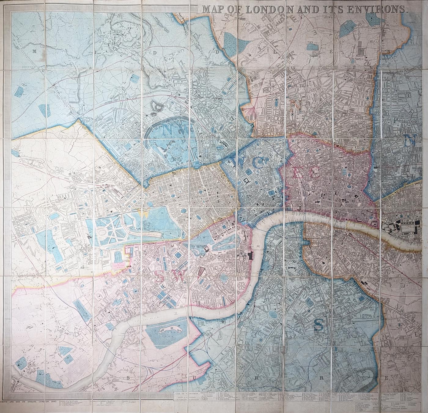
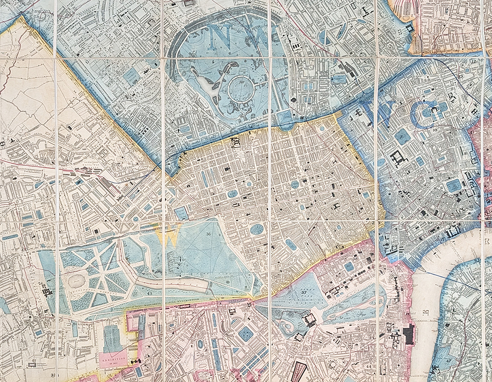
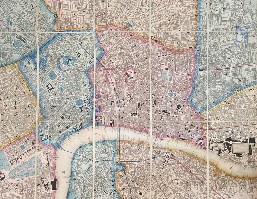
London and Its Environs, 1862
Publisher: Charles Smith and Son, 175 The Strand, London
Date: 1862
Subject: London and its environs
Coverage: Fulham, London Docks, Peckham, Hampstead, Stoke Newington and Clapham
Features: Parish boundaries, postal districts, railways and decorative border
Format: Dissected and laid on linen with velum covers
Hand colouring: Original
Map size: 1450 x 1450mm (approximately 57 x 57 inches)
Condition: Dissected and laid on linen, with vellum covers at diagonally opposite top and bottom corners. Original hand colouring, slight wear at folds, minor age toning and offsetting.
Description
Large-scale map of London extending from Fulham in the west to London Docks and Peckham in the east, and from Hampstead and Stoke Newington in the north to Clapham in the south.
The map has a deep decorative border, a key to boundaries at lower left, and a table of 67 parishes added to the centre and lower right. Postal district boundaries are depicted in colour and several railways are shown.
There are pencil annotations in the upper right, north of Highbury, indicating ownership of two fields by Samuel James and Isaac Walker.
This example is particularly scarce. It does not appear in the reference books in this exact form and differs from Smith's listed map in its reduced eastern extent, deeper decorative border, shorter title and additional parish key.
Image size: 1450 x 1450mm, 57 x 57" approx.
£745.00
Antique Map of London and Its Environs 1862
Order No. 4814
Free UK Mainland Delivery
Large-Scale Antique Map of London, 1862
Charles Smith's 1862 map provides a detailed picture of London during the nineteenth century. Its large format allows considerable detail to be shown, including streets, railways, postal district boundaries and parish boundaries.
Conservation Framing for the 1862 London Map
At approximately 1450 x 1450mm, this exceptionally large antique map makes an impressive display piece. Conservation framing can provide attractive presentation while helping protect the original map from handling, dust, light and environmental conditions.
We can advise on suitable conservation mounting, glazing and frame styles for this large historic London map, including options appropriate for antique and hand-coloured maps. Explore our conservation framing options for antique maps.
Areas Shown on the 1862 London Map
The map extends from Fulham in the west to London Docks and Peckham in the east, and from Hampstead and Stoke Newington in the north to Clapham in the south. The extensive coverage makes it an interesting record of London's expanding urban landscape.
Features of Charles Smith's London Map
The map has a deep decorative border, coloured postal district boundaries, a parish key and a table of 67 parishes. Several railways are also shown, providing an interesting record of London's transport network in the nineteenth century.
Charles Smith and His London Maps
Charles Smith and Son were London publishers associated with maps, directories and geographical publications. This 1862 map provides a detailed representation of the capital and its surrounding districts, combining practical geographical information with decorative engraving.
A Scarce 1862 London Map
This particular example is particularly scarce. It differs from the version described in the reference books, with a reduced eastern extent, a deeper decorative border, a shorter title in larger lettering and the addition of a parish key. These differences make this an unusual example for collectors of antique maps of London.
Related Antique Maps of London
- Antique Map of London 1851 by James Reynolds
- Antique Map of London c.1836 by Thomas Moule and William Schmollinger
- Antique Map of London and Westminster 1840
- Antique Map of London c.1879 by G. W. Bacon
View all antique maps of London
Frequently Asked Questions
When was this London map published?
This antique map of London and its environs was published by Charles Smith and Son in 1862.
How large is the Charles Smith London map?
The map measures approximately 1450 x 1450mm, or 57 x 57 inches.
What areas are shown?
The map extends from Fulham in the west to London Docks and Peckham in the east, and from Hampstead and Stoke Newington in the north to Clapham in the south.
Is the map hand coloured?
Yes. The map retains its original hand colouring, including coloured postal district boundaries.
Is this an original antique map?
Yes. This is an original 1862 antique map, rather than a modern reproduction. It retains its original hand colouring and has been dissected and laid on linen with vellum covers.
Can this large London map be professionally framed?
Yes. Conservation framing options are available, with advice on suitable mounting, glazing and frame styles for the large 1450 x 1450mm map.
Mon - Closed
Tues-Fri 10am-1.30pm, 2.30-5.30pm
Sat 10am-1.30pm
© Devonshire Fine Art
 Free UK Mainland Delivery*
9 Church Street
Modbury
Devon PL21 0QW. UK
01548 830872


