
Antique Map of West London c.1890
This original circa-1890 antique map of West London was published by Stanford's Geographical Establishment. Covering the western suburbs of London, the map includes Paddington, St Marylebone, Kensington, Hammersmith, Fulham and Chelsea, providing a fascinating record of the capital during the late Victorian period.
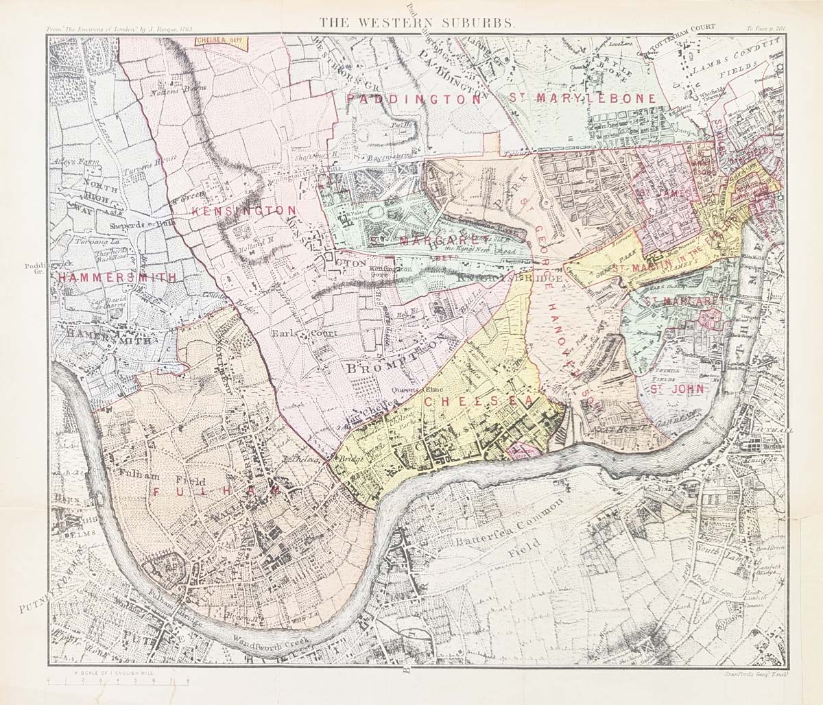
Antique Map of the Western Suburbs of London, c.1890
Publisher: Stanford's Geographical Establishment
Date: circa 1890
Subject: Western suburbs of London
£75.00
Coverage: Paddington, St Marylebone, Kensington, Hammersmith, Fulham, Chelsea and surrounding areas
Historical source: Reproduction of John Rocque's The Environs of London, originally published in 1736
Format: Folding chromolithograph map
Image size: 260 x 300mm (approximately 10 x 12 inches)
Condition: Folding map as published, with a repair to the bottom-left margin. The map image is unaffected.
Original antique map of West London, circa 1890
Order No. 4708
Free UK Mainland Delivery
Description: Western section reproduction of John Rocque's The Environs of London, originally published in 1736. This later Stanford map covers the western suburbs of London, including Paddington, St Marylebone, Kensington, Hammersmith, Fulham, Chelsea, St John, St Giles-in-the-Fields and Covent Garden.
Explore conservation framing options for this antique London map
Antique Map of West London c.1890
This late nineteenth-century antique map records the western suburbs of London during a period of considerable urban expansion. Published by Stanford's Geographical Establishment circa 1890, it covers an area stretching across districts including Paddington, St Marylebone, Kensington, Hammersmith, Fulham and Chelsea.
The map provides an interesting picture of the changing character of West London during the Victorian period. Streets, roads and settlements are shown in detail, making the map particularly useful for anyone interested in the historical development of London's western districts.
Stanford's Geographical Establishment
Stanford's Geographical Establishment was one of the leading British map publishing businesses of the nineteenth century. Stanford maps are valued by collectors for their detailed geographical information and their record of Britain's rapidly changing towns, cities and landscapes.
This circa 1890 map of the western suburbs of London is a good example of the detailed cartographic work produced for Victorian London. Its combination of historical interest and decorative appeal makes it suitable both for collectors of antique maps and for display.
John Rocque and The Environs of London
The map is a later reproduction of the western section of John Rocque's The Environs of London, first published in 1736. Rocque's survey is an important historical record of London and its surrounding area. This later Stanford reproduction allows collectors to appreciate the earlier mapping of London's environs in a nineteenth-century printed format.
Areas Shown on the West London Map
The map includes a wide range of historic districts and neighbourhoods, including Paddington, St Marylebone, Kensington, Hammersmith, Fulham and Chelsea. It also includes St John, St Giles-in-the-Fields and Covent Garden, providing an interesting view of the western and central parts of London.
View all our antique maps of London.
Conservation Framing for This West London Map
At approximately 260 x 300mm, this antique map is well suited to framed display. Conservation framing can provide an attractive presentation while helping protect the map from unnecessary handling, dust and environmental conditions.
We can advise on suitable conservation mounting, glazing and frame styles for this Stanford map. Explore our conservation framing options for antique maps.
Related Antique Maps of London
Mon - Closed
Tues-Fri 10am-1.30pm, 2.30-5.30pm
Sat 10am-1.30pm
© Devonshire Fine Art
 Free UK Mainland Delivery*
9 Church Street
Modbury
Devon PL21 0QW. UK
01548 830872


